Fermynwoods residency: a night out with the stars
Following on from previous nocturnal outings, I did my first wild camp.
Aeroplanes: lots.
Trail bikers: none.
Stars: many.
Meteors: not a sausage.


Following on from previous nocturnal outings, I did my first wild camp.
Aeroplanes: lots.
Trail bikers: none.
Stars: many.
Meteors: not a sausage.
Yesterday I met up with Isabella Streffen for the first time; our ‘meeting up for lunch’ stretched into five hours chatting about, shall we say, diverse subjects. In amongst the wide-ranging topics of conversation, we spent some time talking about my experience of going for a night walk, and unpicking where the different fears came from.
We agreed that the instinctive reactions to twigs snapping and unidentified sounds from the undergrowth were Good Things and there for a reason. We were more critical of the lifelong cultural conditioning we’ve had as women that has trained us to fear the consequences of going out at night alone. We talked chances; we talked transgression; we talked reprisals and we talked about wrestling wolves.
Hear. Us. Roar.
Well, after that I didn’t have much choice but to go back to the lodge, pack some bedding and a headtorch into my panniers and set off for a night in the woods.
…unfortunately, as I was leaving, I met the father of the family in the Lodge next door, and he primed me tales of off-grid campers, grumpy men with rifles, trailbikers, illegal raves and other such things I might encounter. Great.
I went anyway.
My destination was a coven of wooden sleeping shelters out in the woods. I’d done a quick recce on my way back from meeting Isabella and had decided the foil-based detritus was almost certainly evidence of enjoyment of small apple pies and nothing more sinister. (Did a quick litter pick, too.)

I returned whilst there was still a fair bit of light left in the day, so I could see what I was doing as I was getting myself sorted. Once that was done I perched on a log and read a bit more of Macfarlane’s The Old Ways, which seemed like entirely appropriate reading material.
The light faded rapidly, so the reading had to come to an end.

That’s when the bats started.
Sadly it seems I can no longer hear bat chirrups, although these were flying close enough that I could hear the bustle of their wings as they went past.
I had a go at filming them:
Okay, not my best wildlife photography, even alongside the high standards I’d already set earlier in the week:
True fact: all the animals around here are *really* blurry. pic.twitter.com/BrBzzsPtNx
— nikki pugh (@nikkipugh) August 12, 2016
Time for bed.

…which is about the time the trail bikers started hooning up and down a nearby track…
They went after a few laps of the woods, and then it was just me and the grasshoppers. Flippin’ ‘eck the little creakers can stridulate all night long. I mean it: there was one just outside the shelter. All. Night. Long.

There were a few other rustles and patters over the course of the night, but nothing to be seen, which I was a tad disappointed about if I’m honest. I mean, if you’re going to sleep in a wooden box out in the woods, you at least want some good stories to tell afterwards, right?
I didn’t actually get much sleep – in a first night of camping style – but eventually it was morning and that was that.

The worst that happened? Three midge bites.
As part of the current residency with Fermynwoods Contemporary Arts, I thought I would like to use the opportunity of being in the middle of nowhere to really engage with darkness: there must surely be as little light pollution here as I’m likely to encounter anywhere else and, through chance and careful planning, my 10 days span the peak of the annual Perseids meteor shower.
Last night was supposed to be the night to be out gazing up at the heavens, so needless to say that was when we had cloud cover all night. Yes, I did keep getting up to check.
It’s the most gorgeously blue-skyed sunny day today though, so maybe I’ll have better luck tonight.
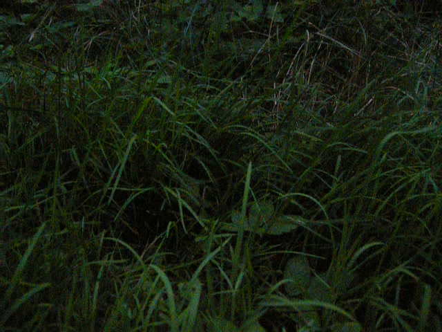
I did also do a little bit of nocturnal venturing forth a few nights ago (Tuesday, I think. Not sure. I’m starting to lose track of time a bit…).The place where I’m staying is reached via a 2 mile long stretch of track that weaves between and around different patches of woodland. Half way between the Lodge and the road there’s a bit that I always find just a little bit glorious as the track breaks out from the tree cover and, for a few hundred metres, has a field on either side and views of rolling hills beyond that. I think I especially like it because a footpath cuts straight across one of the fields, visible in the scrub as two burnished lines of compressed earth.


Anyway, I digress.
This is the scene I really want to recount:

Just as the last hues of the sunset were loitering around the horizon, I set off purposefully from the Lodge towards that halfway field. Then I went back in for my camera. Then I set off purposefully again, serenaded by crickets or grasshoppers or somesuch in the grass either side as I approached the entry point onto the woods. It’s probably not quite the word I’m looking for, but I also got strafed by a hare and some moths in this first hundred metres.

I resisted using a torch for this outward journey, mostly because I think that cone of light does as much to restrict your vision as it does to enhance it. Whilst that first, open, section of track was pretty easy to navigate, I anticipated things getting interesting once the trees closed in. We all know how it goes in the half-light: twigs snap, shadows play tricks on your mind, it’s easy to get disorientated and it all gets a bit scary. We know it. It’s so predictable it’s boring. Even so I was still a little bit surprised to ‘see’ a lion in the ditch to the side of me. Huh. Explains the electric fence back at the Lodge though, I suppose…
Anyway, if anyone asks why I was walking so fast down the track, it’s because I wanted to get to the halfway field before the light faded completely, alright? Heart beating perhaps slightly more rapidly than the fast pace warranted, I decided it was actually quite cold and, having failed to have remembered to pack a wooly hat for an August residency, I reached for my cycling cap, hoping it would at least keep some of the wind chill off. I made that cap and, being a ginger, I made it with a slightly larger than normal peak to try and reduce my chances of sunburn. Turns out that that’s not what you want when you’re walking through the woods at night. *flip* Probably the only time I’ve worn it with the peak up.
Minutes later a Land Rover comes towards me: headlights on full beam and a hare – all legs and ears – running so fast in front of it down the middle of the track that it didn’t notice me until a brain’s post-processing delay after it had passed, then it skittered sideways for a few paces, ran on some more and then figured out that if it got off the track all would be well.
Waiting until they had both passed, I got back onto the track from the verge, switched off the torch I had flicked on, and continued on my way, grateful that when coming through on my bike earlier I had paused to clear some of the bigger branches strewn around as a result of the Forestry Commission works being carried out. The smaller debris helped me to locate where I was … except I haven’t got much of a sense of distances and directions for that journey even in daylight. It’s more like a series of punctuations and instructions – I don’t know how it all relates in space. In the dark, distances stretched out endlessly and the track contorted in combinations of curves that had previously gone unregistered.
I savoured the moment when the trees eventually came to an end and I paused on the threshold, surprised to see that there was still a trace of sunset orange in the sky.

I’d bought a camping chair and a sleeping bag with me so I could properly spend some time here now I had reached my destination. I’m so glad I brought that extra cover – the wind was coming over the field unobstructed and it was very chilly.
I set myself up at the corner margins, knowing full well I was also setting myself up for anxious paranoia at every leaf rustle and twig crack coming from the bushes behind me. I soon faced a choice: wrap myself up snugly in the sleeping bag with minimal skin showing, or suffer a bit of cold, but without muffling my sense of hearing. I chose the latter, but I’m wondering if I should have chosen the former, because I frequently found myself turning around expecting something to be behind me. Eventually I figured out it was the bag’s label flapping about in the wind.
It got me wondering about how different the experience was to camping, when a fragile sheet of 20 dernier ripstop nylon is enough to form a protective barrier against all but the most invasive of predators (slugs?) and most fears about the unseen.

I sat there for what felt like an hour, but was probably nothing like as long. I might have seen a meteor, but then again it might have been a satellite. I saw lots of aeroplanes, and gradually the stars came out. In the distance a dog barked, and all the other clichés too. How can I make an interesting piece of work in response to the night that moves beyond all these tired tropes of fear and the stars?
I sat there for what felt like an hour. I sat there for long enough to see the moon had moved along in its orbit to now be above a different clump of trees, then I packed up and tackled the return journey back to the Lodge. Definitely by torchlight this time. And perhaps even quicker than the outward journey, hoping each corner would be the one to reveal the field near the Lodge.
Part of me really wants to nail the geography of these woods and the ways through them; another part of me is already sick of following the prescribed paths and wants to keep at least a semblance of mystery or serendipity about moving around the place. I started off the week frequently looking at the map on the screen of my Garmin to locate myself in relation to the cardinal directions and the boundaries of the wood, but I quickly learned that lines on the map don’t necessarily correlate with lines on the ground. As I type this, I’m looking longingly at the fields around the lodge and wanting to go off piste, however the fields are currently being mown so it would probably be prudent to leave that a while. Maybe tonight…
I’ve just started a 10 day residency at Sudborough Green Lodge – Fermynwoods Contemporary Art‘s rural outpost surrounded by forest and fields.
The residency is part of their associate artists programme rather than linked in to a particular commission, so I’m in the fortunate position of not having to work to a specified outcome. This is time I can use to feed my practice, and that doesn’t come along very often.
So I’m here with a handful of questions that I probably wouldn’t get much opportunity to engage with in amongst the usual hectic to-and-fro of my working week. I have questions about how the making of field notes might relate to my practice; I have questions about moving around at night; I have questions about how far my ailing knees and feet will carry me nowadays; I have questions about whether I can still draw; but mostly I get to find out what happens when I have time and space in which to follow my curiosity.
Coming after several months of flirting with burn-out, this has all required something of a change of gear. …and giving myself permission to not to anything in particular in these first few days. There have been lie-ins and reading of good books and exploring.
When I was here last – 4 years ago – I was making the Landscape-reactive Sashes ready for deployment as part of the Corby Walking Festival. I remember spending a lot of time hunched over sewing machine and soldering iron, and I remember a lot of rain: this meant I missed out on the chance to explore my surroundings, so basic orientation has been top of my to-do list.
I started off by getting a bit lost.

I got on my bike and I started off by turning left at the junctions in the track where up until now I’ve only ever gone right.
I had my Garmin with me, showing the line of my journey thus far as an aid to figuring out where I was in relation to where I’d been …and where I needed to get back to. Fun was had relating the dotted line on the small screen to the rapidly deteriorating surface of the bridleway in front of me. No really – it was fun! I like not knowing what’s around the corner and if you’re going to have to turn back or not; that internal debate between being gung-ho and the bit that tells you enough is enough.

Gung-ho held out just long enough along a grass-covered, deep-rutted, what used-to-be-a-gravel-track for me to find myself at a high seat. No questions about what needed to be done next.

I pushed a bit further along what might optimistically be called the path, hoping to be able to link up with one of the dotted lines on my screen, but a combination of disorientation, brambles and mud made me call time on that avenue of exploration and I turned back to rejoin terra more firmer.
Rinse and repeat for about 10 miles in total.

I had half an eye on looking for suitable places to come back to at night. There were a couple of more promising looking high seats, but they were padlocked and not for public use in quite a definite manner.
Other than some purpose-built shelters, it looks like some field margins might be my best bet. Mostly however, we’re in the traditional Forestry Commission configuration of track>ditch>fence. I shall have to keep my eyes open for opportunities for getting beyond that.
Alongside my beating of the bounds, I’ve also started reading Robert Macfarlane’s “The Old Ways” and am loving it. It seemed like it was going to be a relevant read to hold back until I was here, and early indications are that it’s not going to disappoint.
As I progress with my explorations – mostly by bike, so far – I keep getting trapped between busy A-roads and byways that are probably best left to the ramblers and the horse riders. There’s not a lot in the middle, either in terms of volume/speed of traffic or of routes that link up.

I managed a 20 mile circuit yesterday that had minimal A-roads, and with my Macfarlane-primed eyes was very tuned in to noticing all the footpaths criss-crossing the landscape. I’d like to explore these more, but not sure if I’m currently rated for more than a couple of miles on foot.
I also noticed lots of churches (that or my route twisted and turned enough that I just saw the same few steeples from an array of different angles). It got me thinking about the size of a parish; about communities and the walking distances between them.
I spent three days last week supporting artist Rachel Henson as she embarked on her 2-week residency at Blast Theory HQ in Brighton.
Rachel’s been investigating the use of haptic navigation devices and moving images off-the-screen. She got in touch after reading my dissertation about the paper-crafted Where the Sky Widens pods and, after meeting for an initial meet-up and chat several weeks ago, invited me to join a team of advisers who’ll be helping her with her R&D.
Where the Sky Widens: An exploration of slow making and spatially-aware prototypes as methods for considering emotional connections to distant places
Rachel’s local to Brighton, so it’s been an interesting experience where I did the packing of equipment, the travelling, the living out of a rucksack and the residing in a liminal sort of space – as per usual for residencies – but without being the actual artist in residence! Rachel’s working towards devising a mechanism for guiding a solo walker to a selected destination in such a way that, along the way, their senses are working in a state of alertness to what’s around them. My three days were to get Rachel and Neil initiated into the world of physical computing before she then fed in expertise about sound and situated visuals from other practitioners.

Living the dream – sunrise over Travis Perkins

“Clean your tip!” Soldering 101
Neil’s a programmer, so the coding side was covered and I focused on skilling them up on working with the hardware: primarily GPS and magnetometers, but then also looking at different actuators that could be used to respond to the data coming in off the sensors. First task: getting them the other side of The Fear that most people seem to experience when working with this kind of thing for the first time. Soldering irons were deployed and we went from complete beginner on Monday, via adding connectors to various components, to Neil assembling an Adafruit Wave Shield on Wednesday!
Alongside the soldering we also breadboarded a GPS+compass system that would tap a solenoid in a heartbeat pattern to guide the walker to a secret location. There seem to be two types of residency venue: those with roofs that are very permeable to radio waves (and everything else!) and those that are somewhat more bunker-like. 20 Wellington Road is a former Victorian icehouse, tending towards the latter, so testing things involved going up three floors to the roof (also street level, thanks to the local gradient!) in order to get GPS reception. Monday was nice and wet and blustery, so we had to get a bit creative with protecting the laptop we were using to monitor the incoming data…

Weatherproofing strategy – hide!
We also did some experimenting with a breadcrumb style approach along a trail in contrast to carrying a navigational device with you all the time. This involved a lot of keyfinders and a lot of whistling!

Call and return with keyfinders

Laying a trail
This almost immediately set Rachel’s thinking off in another direction, because of the way it focused her awareness in and down instead of out. When I left on Wednesday, it seemed the main area of enquiry was going to be on a navigational device at a distance to the walker – in front, but always out of reach, leading the way. They’ll be half-way through the residency now – will be very interesting to how ideas have progressed at the end of next week!
Phase III of The Tour of T’North:

I’ve been building some Colony ‘critter’ variants for exhibition at The Lowry as part of their Right Here Right Now showcase of contemporary digital art. During the exhibition, the animatronic forms will be moving in such a way as to ‘remember’ a walk taken around the surrounding Salford Quays area. This was the data-gathering part of that task where I did the walks and collected the data that would determine the critters’ movements.

Day 1 was my first visit to the Quays and a chance to – literally – suss out the lie of the land. Amidst the drizzle and general greyness I walked around with what I hoped was a not-too-suspicious-looking rucksack full of batteries, GPS equipment, Arduino and data loggers.

The critters are effectively claustrophobic and move more (get distressed) in response to being taken to places where buildings restrict their view of the sky (this links back to the quality of the GPS signal they receive – see the previous post for more information). In order for them to not just be doing the same thing all the time during the exhibition, I was therefore seeking out a range of built environments and collecting the data in order to get a feel for the ranges encountered. Media City provides a selection of massive office buildings with comparatively narrow walkways between them, but the quays also have some plazas and bridges out over the water as open spaces by way of contrast.
No two bridges the same, it seems.
Here’s the non-swinging swing bridge the Detroit Bridge.

I checked the list of banned anti-social behaviours and arting wasn’t on there, so I did a few circles of the viewing platform en route across to the other side.

The data I collect are in the form of many (tens of thousands) lines of text and numbers. To help me quickly see what sort of values I got and to relate these back to the landscape, I often convert the data into visual form and view them in Google Earth. Here’s the visualisation of the walk from that first day:

I had two different sets of kit in my rucksack, so each is represented by a different colour. The quick way of understanding what the visualisation shows is to think that the length of the lines corresponds to the extent to which the GPS signal is being affected by the built environment. It’s also important to remember that the lines can be deflected away from the actual path I took – I didn’t get my feet as wet as some of these traces might suggest! For example, the lines over the water towards the bottom left of the image above, were produced when I walked along the base of the wall of the Imperial War Museum; the effect of this massive piece of architecture being to throw the calculated GPS positions off by several tens of metres.

The imagery currently in Google Earth is somewhat old, showing Media City as it’s being constructed:

I really like this combination of seeing the promise of the buildings that don’t quite exist yet and the invisible effects they then went on to have on the radio waves that also fill that space.
Having retired to my accommodation and spent some time examining spreadsheets and ranges, I returned for day two of the data-collection. This time with two critters.

The skies were clearer this time around and I was met by Aliki Chapple, who had generously volunteered to spend the afternoon doing odd things in public places with a stranger off the internet.
Once fully bedecked in our moving wooden sculptures and their fabric slings, we set off to explore.

By the end of the afternoon we had completed two different pairs of walks: the first was a bit of an epic loop around the edge of the Quays, mostly encountering different residential environments; and the second was a shorter one centred more on The Lowry and the Media City end of things.
Again we experimented with the effects buildings would have if we walked close to them; but we also encountered smaller masses and also had some interesting conversations with befuddled, inquisitive people we passed on our journeys. This is what Colony is really about: using the critters as a tool and as a permission object to pay attention to and explore the spaces we inhabit. They are also deliberately intended to be a conversation-starter.


Needing somewhere to safely leave the critters whilst we went to find some food, we also had some nice interactions with the staff at The Lowry – the cloakrooms were briefly home to some unusual inhabitants!

Here are the visualisations of all four of the walks:

I was surprised by how little variation we got in the first, more residential, areas we walked in, although I was naturally expecting the overall effect from buildings to be less pronounced.

These screenshots are from Google Earth with the 3D buildings layer switched on. This is more up-to-date than the flat, base imagery, and it gives a real sense of that relationship between concrete and line length – check out the area in front of The Lowry (top right in the image above, with the tower) and also alongside the multi-story car park for the Lowry Outlet shopping centre (top centre – the blue lines are me walking from right to left along the base of the carpark wall, and then returning on the opposite side of the water, on the far side of the blocks of flats.):
Here are the lines from all six of the walks – quite a lot of ground covered!

Next steps: converting these lines into code that the exhibition critters will remember and play back.
A collation of data, documentation and discussion for participants of the walk around Gretton, the Brookfield Plantation and Rockingham that took place on the 6th of May…
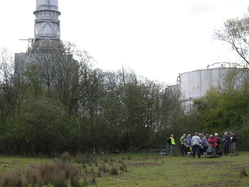
Walk leader David Craddock from the Ramblers was kind enough to let us infiltrate his 8 mile walk with the landscape-reactive sashes.
This was the first outing for the sashes and also the first time I had used my differential GPS set-up in a rural landscape, so quite a step into the unknown…
So many people had volunteered to wear sashes that there was none for me to wear, so my feedback on how things were working was mostly done by quizzing people as we walked or listening carefully to try and hear the buzzes!
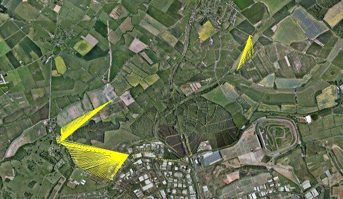
Here is a screenshot of my traces from the morning overlaid onto Google Earth.

It was a long route, so the lines don’t really show up at this level of zoom, except for the ‘major incidents’…
Starting clockwise from the top, the first spray of lines is fairly apt, as this marks the spot where one of my GPS modules fell off! It was some time before I noticed, and a while after that before, retracing our steps, we eventually found it submerged in a muddly puddle. Many, many thanks to the lady (Karen?) who came back with me to help me look. She also donated some tissue for the clean-up and, miraculously, a few minutes later the module was dried off, plugged in and working again. Phew!
My lines disappear as we enter the Rockingham Plantation; not due to interference, but the slightly more mundane reason of the battery running out! Although this was spotted pretty quickly, it was some time before the logging commenced again and, since we were still hot-footing it to try and catch up with the rest of the group, we covered quite a lot of ground in that interval.
The sight below was a very welcome one and made that much sweeter by the flecks of yellow from the sashes and the cries announcing that they had suddenly resumed buzzing as I came back into range!
The above point also marked the transition of the walk from rural to urban landscape as our route skirted along the edge of industrial parks on the outskirts of Corby. If you click through to the original – and slightly larger – image you can just about make out that at this point the lines get a bit longer.
Each line represents where my two GPS modules think they are at a moment in time – one end of the line is one module, the other end the other module. Therefore, the more they disagree, the longer the line is.
Out in the open, the modules get a pretty much direct line-of-sight connection to the signals coming from the satellites – the modules calculate similar positions and the lines are very short. (The sashes would have given a few short, weak buzzes.)
As we make our way through the large warehouses and factories, however, the GPS signals are more likely to reach the modules by indirect routes, bouncing off the buildings en route. The extra amount of time this takes affects the calculations of position. My lines get longer and your buzzes get more energetic.
As our route bends around to the left, something happens to cause one of my modules to lose its fix altogether. Here one end of the lines are fixed to a single point, whilst the other ends follow the route we walked. This happens again as we turn off the road onto the Jurassic Way (I think I changed batteries here.)
So, an interesting set of lines that tell a story, although it wasn’t what I set out to find out about! The lines from Charlotte’s logging device tell that particular story a lot better. Below are some excerpts (click on the images to see the original on Flickr), or you can download the .kml files, open them in Google Earth and have a good ol’ poke around. Part 1, Part 2.

Overview of the route taken (no major incidents!)

Smaller lines get bigger as the group enters the dense woodland of the plantation

Close-up of the lines produced when walking through the plantation - here it's obvious that the GPS modules think they're much further apart than they really are

The large buildings of the industrial units also produce long lines

Clusters of longer lines show where the group paused under trees to take turns crossing the stiles

The tunnel under the railway track

Leaving and entering Gretton village at both ends of the walk
So, some nice results there – both expected and unexpected!
I really liked how the group looked wearing their sashes and the resulting traces tell some interesting stories about the physicality of the landscape(s) we moved through.
You can try the GPS tag for more blog posts I’ve written relating to my work with GPS around the world, and the full set of my photos from this walk is at http://www.flickr.com/photos/nikki_pugh/sets/72157629978908541/with/7002887160/. Edited highlights here: http://www.flickr.com/photos/nikki_pugh/sets/72157629635144548/
Thanks to everyone who took part and to David for leading the walk.
This weekend is that of the Corby Walking Festival and as part of my residency I’ve been commissioned to lead (or infiltrate) 3 events.
The first was on Saturday, when we took one of the Possibility Probes for a walk around the area by the Corby Cube – a mixture of town centre, great big architecture and a footpath through some woods.

Not much response from the probe until the swimming baths send it off the scale...
With mighty cold temperatures, squally showers and tuned-to-Birmingham settings that had worked well on our test walk but didn’t seem to be giving us much feedback now, we put up a bit of a fight but then conceded and headed to a cafe area in the Cube to look at the traces and have a good ol’ chat.

Annotated traces gathered on the Corby event - click for larger version
The second event was an 8 mile walk led by rambler David Craddock, for which I made some landscape-reactive sashes.
The weather was kind, there was a good bunch of people – many willing to don sashes – and the recalibrated code gave much better results. More discussion and results to follow, but here are a few images (courtesy of James Steventon, Fermynwoods Contemporary Art) in the meantime…

Mid-way pause and reunion

Concrete canyon, Gretton style

The group (and additions of yellow) make their way through the countryside

view from the top
We’ll be taking the sashes out again today for a 3 mile walk between Fermyn Woods Country Park and Lyveden New Bield.
Last year artist/historian/typographer/tourguide Ben Waddington came to me with an invitation to be his partner in crime for making something rather exciting happening…

Ben Waddington makes you look up.
Frustrated at the lack of interesting walking tours (in a city that should really be able to do better), and at the lack of visibility for the stuff that is going on, Ben had resolved to do something about it and organise a festival of walking.
After sounding out various artists, historians, architects and enthusiasts, getting a hugely positive response from loads of people keen to share their perspectives of Birmingham, the result was inevitable and Still Walking was born.
Still Walking (a pilot festival for what we hope will be a regular annual celebration of all that walking is and might be) will take place from the 15th March – 1st April later this year. For those of you who like your Interesting Things, that’s sandwiched cosily between the Flatpack film festival and the Fierce festival of live-art-and-things-that-are-a-bit-difficult-to-categorise, both of which we’re partnering with to bring you a great big chunk of amazinteresting this Spring!
We’re awaiting funding decisions before we can finalise the programme and unleash a full website on you but, whatever the outcome, there will be a selection of guided tours, expeditions, instigations and processions offering you the opportunity to see Birmingham in a fresh light.
Our provisional programme spans film, TV, health, history, art, science, fact and fiction. What more do you want?!
Oh, ok then, expect an afternoon of lurve, too…
It’s going to be ace.
We have a holding page up at http://www.stillwalking.org/ where you can sign up to one or both of the mailing lists; Ben’s on the other end of the @StillWalkers Twitter, ready to talk the walk; and there’s a StillWalkers Flickr Group that we’d like to fill with walking goodness…
You’re cordially invited to plug yourself into any or all of those channels and to join us in becoming Still Walkers.
Whilst we’re waiting to be able to announce the programme, we’d love to hear from you if you’d like to volunteer for the upcoming festival or to offer an event for next year’s shindig. We’re also asking which Brum celebrities you’d like to see leading a guided tour of Birmingham.
In the meantime, spread the word: Still Walking is coming soon!
Copyright and permissions:
General blog contents released under a Creative Commons
by-nc-sa license.
Artworks and other projects copyright Nicola Pugh 2003-2024, all rights reserved.
If in doubt, ask.
The theme used on this WordPress-powered site started off life as Modern Clix, by Rodrigo Galindez.

