February 7, 2017

Not quite Harter Fell

This post was originally published over on the By Duddon’s Side project blog: http://byduddonsside.wordpress.com
~~~

Having successfully driven over Wrynose Pass, my plan was to then get out of the car and do a bit of walking. Online, I’d found a short circular walk that included climbing to the top of Harter Fell, where I’d also read the views could be great. Whilst I wasn’t sure I’d have a clear view, I thought I’d give it a try and, if I could , then that would be a great way of getting a sense of the valley.

Between Duddon and Dunnerdale Forest

Starting from the carpark near Birks Bridge, I negotiated some boggy ground before entering what the walk’s author had described as ‘desolate forest’. It was an uncannily good description. The photo below doesn’t really convey the feeling of it, but perhaps you get an inkling.

desolate forest

Hardknott forest is currently being restored from a conifer plantation to “native habitats of oak and birch woodland, bogs and open ground”. Well, I’d already found the bog, maybe the desolation was also by design?

Riding up out of the forest at Birks, I relocated the bridleway and, it turns out, lots more bogginess. There was a lot of water running off the fell, and in some places the track I was following was indistinguishable from a stream bed.

As I got higher, the way became harder to spot and, with the arrival of some rain showers, also quite slippery.


Mart Crag

I weighed my options and decided that it was probably best for me to cut my losses, turn around and head back down into the valley.

A couple of quick photos whilst perched on a rock, and then the rain started in earnest and I had to find a relatively flat spot on which to wrestle on my waterproof trousers!


Mart Crag

Mart Crag

This is as far as I made it before turning back (the blue line shows my track and the yellow line was the rough route I was hoping to follow):

Harter Fell (ish)

I think that means I made it onto Mart Crags, but not really anywhere near the top of Harter Fell. Oh well.

Having done a bit more reading online since, I think if I tried it again I would use the more southerly route that I had intended to use for my descent. There’s a nice write up of this alternative route here, with some lovely photos taken on a gorgeously clear day.

After returning to Birks I veered off to the right rather than retracing my steps back to the car. I wasn’t sure what to expect by this stage, but hopefully it would be a bit drier!

After a going over some fields and a little bit – but not too much – squelch, the bridleway nipped over a stone wall and suddenly I was following a nice wooded track.

Between Birks and Gold Rill Dub

Between Birks and Gold Rill Dub

I really liked this stile without an obstacle that looked a bit like some odd seating arrangements or some sort of minimalist sculpture.

Descending further down into the valley I increasingly became aware of the sound of pounding water. Ah! I must be getting close to the Duddon again!

The path took me close to the edge of a steep drop which I was reluctant to approach any closer, so I listened to the river for a while longer without being able to see it. Rounding a corner there was this dinky little bridge and Duddon itself. Now I could understand what all the noise was about!

Between Birks and Gold Rill Dub

Gold Rill Dub Gold Rill Dub

Crossing at the wooden (and very slippery) footbridge, I regained the tarmac’d road and made my way back to the car park, stopping off every so often to take a few photos.

Between Gold Rill Dub and Birks Bridge car park

Here’s one looking back up at the summit of Harter Fell. (Or where the summit should have been.) Probably just as well I didn’t push on for the top, as I don’t think I’d have seen much….

Between Gold Rill Dub and Birks Bridge car park


Over the top

This post was originally published over on the By Duddon’s Side project blog: http://byduddonsside.wordpress.com
~~~

Having chickened out of it on my quick recce to the Duddon Valley a fortnight ago, the time had come to bite the bullet and see if my car was up to the challenge of driving over Wrynose Pass. Success here would influence logistical decisions later on in the project, so I had to find out if it was an option or not.

morning walk into town

The view from Dove Cottage in the morning was of snow-dusted peaks and lingering cloud, so I wasn’t sure what I would be met with once I started to climb the pass.

Wrynose Pass

Well, a closer view of the snow, for a start!


Wrynose Pass

Wrynose Pass

Also some glorious views and dramatically-lit landscapes.


Wrynose Pass

I justified several photo stops in terms of giving the car a chance to cool down a bit!

I reached the top with no automobile-related dramas and crested the top of the pass to be greeted with…

Wrynose Pass

Ugh! A valley full of raincloud! Typical!


Wrynose Pass

It brightened up for a few more photographs and an opportunity to pause and reflect on how rapidly the Duddon had grown from the tiny little becks I’d seen earlier, to something that could now reasonably be called a river.


Cockley Beck bridge


I found myself wondering how one would have traveled between Grasmere and the Duddon Valley at the end of the 17th Century. Would it have been something you could have done as a day trip, or would it have been an undertaking of a few days?


First encounter with the Duddon

This post was originally published over on the By Duddon’s Side project blog: http://byduddonsside.wordpress.com
~~~

I travelled up to the Lake District for a preliminary meeting at the Wordsworth Museum. Having a bit of time to spare I thought I’d take a detour to check out the valley that will be the main focus of this project.

Visibility was somewhat reduced and it was quite squelchy underfoot, but after 10 minutes strolling around on the banks of the Duddon near Ulpha I could understand that this place is a little bit special – I’m very much looking forward to having a proper explore.

32373633042_4b1a704b31_z

32403970101_8bcb0fe169_z

31713757443_b0639b8893_z

32373262562_83324bff4f_z

Announcing ‘Deep Mapping the Duddon’

UPDATE: This project is now called “By Duddon’s Side” and is being documented over at https://byduddonsside.wordpress.com

The River Duddon

Photo by casper_chole on Flickr, CC by-nc-nd, click for original

Back in September I was awarded a Visiting Fellowship by the Centre for Mobilities Research at Lancaster University to help support a collaboration with Dr Christopher Donaldson (Lecturer in Regional History and Co-Investigator on the Leverhulme Trust-funded Geospatial Innovation in the Digital Humanities: A Deep Mapping of the English Lake District project, also at Lancaster University). Since then Chris and I have been working hard to link things and amplify things and – following on from receipt of additional funding from Arts Council England – I’m very happy to now be able to announce that for the next few months I’ll be working with Chris, primarily based in the Lake District.

We’ll ‘deep map‘ history and memory in the Duddon Valley, where the Geospatial Innovation research group’s work will also support the Wordsworth Trust to explore different ways of increasing public engagement with the works of William and Dorothy Wordsworth.

In addition to featuring in the work of the Wordsworths, the Duddon Valley was home to prehistoric and Roman remains, medieval longhouses, and ancient farming communities. It has a strong industrial past (mills, quarrying and an iron furnace) and nowadays attracts tourists ranging from fell walkers and mountain bikes through to those taking a more leisurely approach to exploring the area.

I like a good palimpsest of landscape and stories!

Our activities will map how different layers and traces overlap and interact to contribute to community identity and sense of place. Chris is already working with local groups to research a collection of Victorian and Edwardian photographs of the valley. I’ll be helping with this and also developing my own site-specific tools and processes for engaging with the stories of the Duddon Valley. Later we’ll be bringing these together in an exhibition at the Wordsworth Museum (Grasmere) and I’ll be working with Chris and the Trust in designing something that we hope will prove to be multisensory and interactive.

Sign up to my newsletter for updates as the project develops, or follow along in real time on Twitter.


Duddon Valley

Photo by andrew_annemarie on Flickr, CC by-sa, click for original

~~~

Supported using public funding by the National Lottery through Arts Council England.

Additional support from Lancaster University (Geospatial Innovation in the Digital Humanities, Department of History, Centre for Mobilities Research, Lancaster Institute for Contemporary Arts) and the Wordsworth Trust.

…further adventures in Japan


Fuji from the plane

Having got as far as Tōkyō to take part in the Playable City lab, it would have been a shame to have turned around and gone back home again after only a week. So I didn’t.

What I hadn’t really planned for was my explorations to start with a trip to hospital, but there you go; it’s all good learning.

hospital

I learned that there isn’t really a GP equivalent in Japan and so if you’ve caught a lurgy you join all the hundreds of other people being herded around the hospital in an efficient manner. Somewhat bewildering without enough of the language, but with some supplementary pointing, and after being politely relieved of some money, I got some meds and was eventually on my way.

First stop was Hakone, where I’d decided to treat myself to two nights in a ryokan.

ryokan

ryokan meal

ryokan

The wikipedia article starts by describing ryokan as “a type of traditional Japanese inn that originated in the Edo period (1603–1868), when such inns served travelers along Japan’s highways. They typically feature tatami-matted rooms, communal baths, and other public areas where visitors may wear yukata and talk with the owner”. Having gazed longingly at the clear blue skies from my hotel room window when I was too ill to go out and play in Tōkyō, in my chats with the ryokan staff we joked that I was a rain god. Yup, you’ve guessed it: I’d planned to do some walking around Hakone and, for the two days I was there, it was pretty miserable weather.

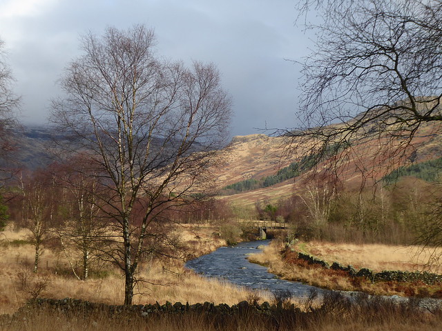
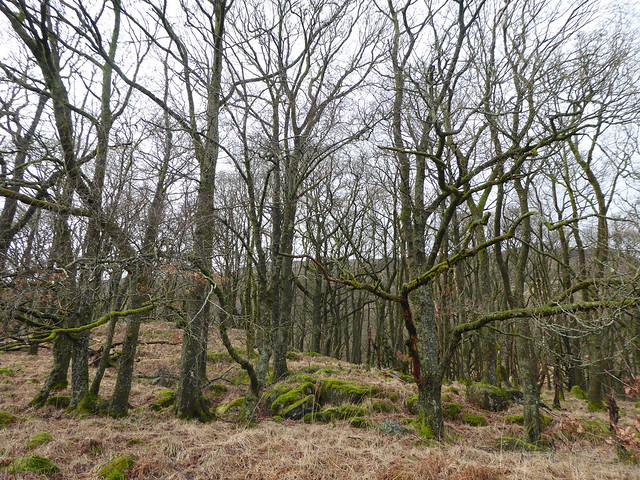
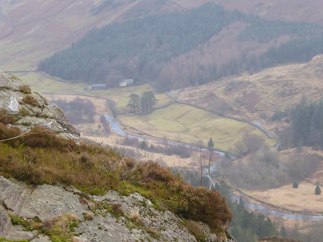
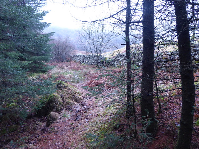
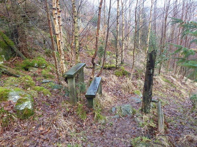
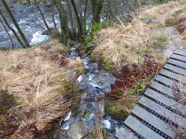
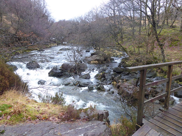
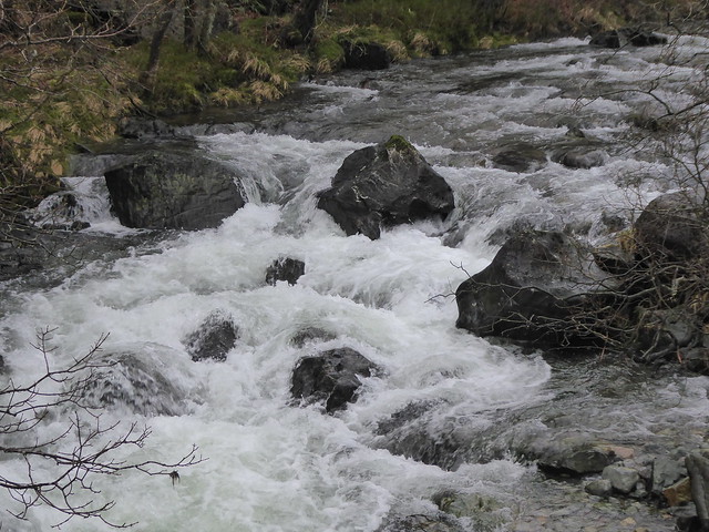
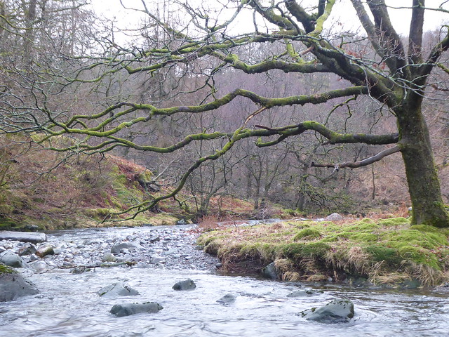
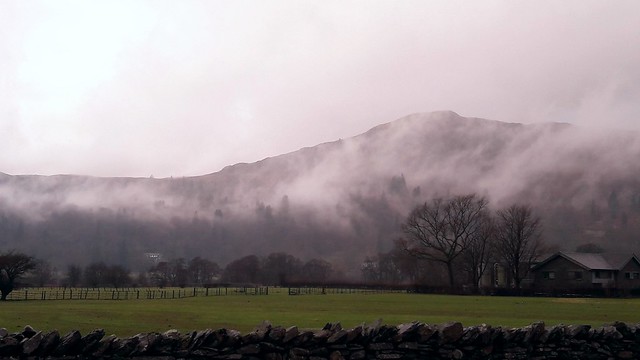
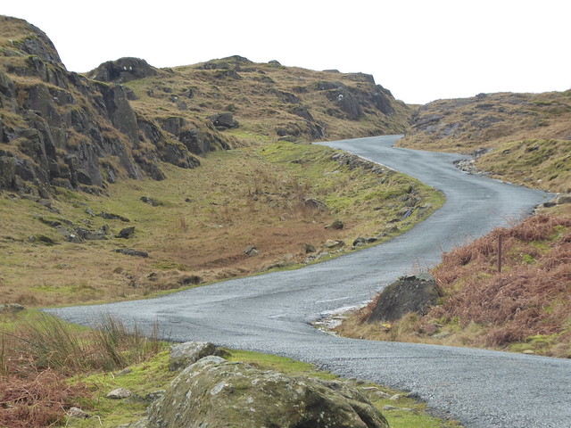
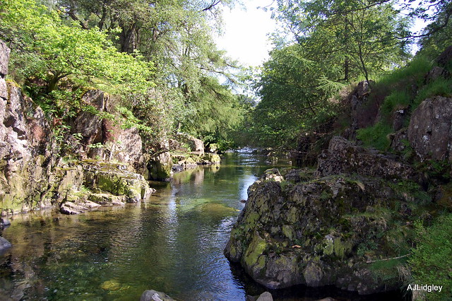
Armed with my kagoul, a sense of humour and slightly inadequate maps, I set off to walk along a well-preserved section of the old Tōkaidō highway that used to be the main route between Kyōto and what is now Tōkyō. My ryokan was close to the Hakone Sekisho (security checkpoint) so I had a look around there first before setting off up the steep wooded slopes along the ancient cobbles.

Hakone Sekisho

old Tōkaidō highway

Pretty mind-boggling to try and imagine what this road was like 400 years ago with volcanoes and earthquakes adding to all the usual human-powered perils.

Apparently, around here is the re-routed section that was built to make the going less steep. No wonder it was travelled by foot and not by wheeled transport…

I only walked a few miles, but was grateful when I reached the amazake chaya serving its cups of warm, sweet, fermented rice drink. The room was dim and full of slightly biting wood smoke from the fire, but check out the size of that brass kettle between the table and the counter in the background for a sense of how this place has traditionally provided a welcome haven for the travellers that stop off here!

amazake chaya

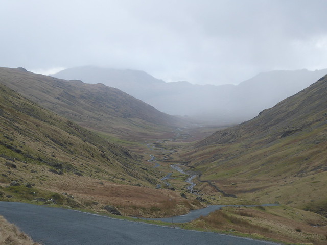
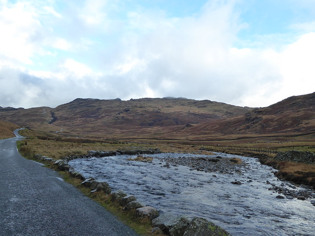
From the tea house I opted to make use of my Hakone Free Pass and take the white-knuckle roller coaster bus ride over to Hanone Yumoto and then the Tozan Railway and Cable Car (funicular railway) up into the mountains. Unfortunately the Hakone Ropeway (cable car) wasn’t operating by the time I got to Sounzan station, so I retraced my steps back to Yumoto through the drizzle and failing light and then braved the bus once again to return to the ryokan.

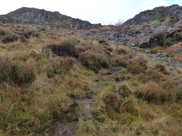
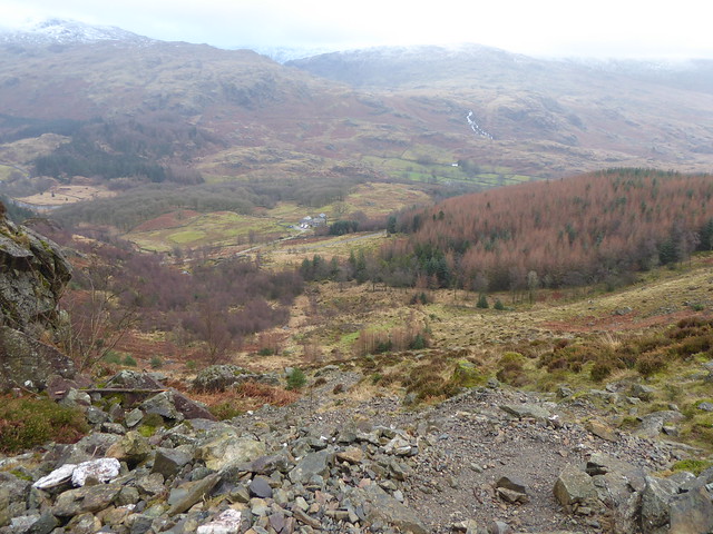
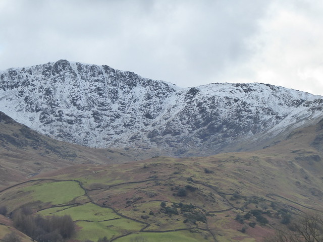
The next day was even wetter, but I still had the Free Pass and I was determined to use it so I attacked the mountains from the other direction: taking a ferry boat mocked up as a replica HMS Victory across the lake and then the Ropeway up to Ōwakudani.

Ashinoko

Ashinoko Victory ferry

Ashinoko

Wikipedia informs me the name Ōwakudani (大涌谷) literally means “Great Boiling Valley”, which makes perfect sense: steam rises from countless fumaroles as you reach the upper slopes.

Ōwakudani (Great Boiling Valley)

The combined effect of the vents, the strongly sulphurous smell, the scree slopes and the Geomuseum finally brought home to me how volatile the landscape around here is.

I returned to the ryokan, collected my bags and headed off to a friend’s house and significantly more snuggly surroundings …even if I did have to contend with bears and interlopers in my bed.

Bear Hunt oyasumi

A few days later my JR Pass kicked in, so it was time to hit the road shinkansen.

I arrived in Kyōto around lunchtime along with a light snowfall and a reminder that it was indeed December. I’d originally planned to hire a bike, but opted for a walking instead. I popped in on the garden at Konchi-in as the shadows were lengthening and climbed the sanmon gate of Nanzen-ji as golden hour illuminated a pretty good view of the city.

Konchi-in

Nanzen-ji

That afternoon I was mostly fixated by the many amazing rooflines I encountered, so the taking of photos happily continued as dusk fell and I started to make my way down Tetsugaku-no-michi (The Philosopher’s Path), arriving at Ginkaku-ji well after dark when everything was shut.

Nanzen-ji

Tetsugaku-no-michi

Ginkaku-ji Ginkaku-ji

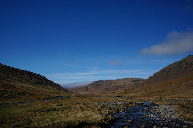
The next day was mostly about trains; travelling the 460-or-so miles between Kyōto and Kumamoto, almost – but not entirely – successfully managing a series of very tight transfer windows at 4 or 5 busy shinkansen stations.

shinkansen view

YCAM

I stopped off en route to meet up with a producer at Yamaguchi Center for Arts and Media who gave me a very interesting tour of the building and the various activities going on there, followed by a slap-up sushi lunch and then a bike to go off exploring with for an hour or so. I was so ready for that bike ride after having been sat on trains since early morning!

My somewhat circuitous route took me over to Ruriko-ji where I had a super quick look at the pagoda and then sprinted back in order to be in time to catch a few more trains.

Ruriko-ji

Ruriko-ji Ruriko-ji

After a minor embarkation error and a bit of on-the-fly emergency plan B-ing, I eventually made it to Kumamoto, in position and ready to make the most of the following few days staying with a friend and her family on the outskirts of the city.

Daylight hours included being taught how to play shogi, making splatty sweets and establishing the level of mime required to communicate (we don’t have much language overlap, but it seems to mostly work out okay). After the youngest young ‘un had curled up and been hit several times with a horizontal rolled up newspaper, we set off into the sunset to the village temple…

inaka sunset

kane

…where we were to watch the 6 p.m. ringing of the bell.

…except it turned out that my friend had been at school with the obõsan so we ended up not watching his wife ring the bell but climbing up and giving it some welly [religious technical term] ourselves. I particularly liked the stone system for keeping count of how many times the bell had been rung. The bell was impressively loud and reverberant from that close, so I can well imagine it would be easy to lose count.

We also learned that the 6 a.m. bell ringing had been ceased after complaints from the locals…

kane counting stones

It then turned out that, whilst we’d been ringing the bell, the obõsan had been inside getting changed into more formal attire and we were then allowed to accompany him into the inner part of the main hall where we got to peer at all the ornate carvings and he explained the significance of various things. Again we didn’t have much language overlap, but I probably learned more about Buddhism that evening than I had done in several visits to Kyōto and all the massive temples there.

local temple

The young ‘uns were back at school the next day, so my friend and I joined a class of 5 year olds (almost as loud as a temple bell!) for a miso making session. It involved some very large bowls, some satisfyingly hands-on mixing of squelchy stuff and then punching the resulting mixture into those bags you can see the background, hopefully with no air trapped inside.

making miso

making miso

I couldn’t take much of our miso back on the plane with me, but a lunchbox full is currently quietly fermenting away in the cupboard underneath my kitchen sink. It’s got to do this for the next 3 months or so and then I suppose it’ll either be green and furry or I’ll need to find someone who actually knows what miso’s supposed to taste like to declare whether it’s ready or not!

What with the miso and the amazake, I’m becoming more and more curious about all the different Japanese foodstuffs made from variants of fermented rice. I’m pretty sure there’s a project in there somewhere, but failing that I bet there’s loads of interesting traditional processes to learn about and wonder at.

blue sheets

After the miso punching we had time for a quick look at Kumamoto Castle. Kumamoto was hit by a large earthquake in April and driving through the city had already been a sobering experience seeing all the signs of the damage done: blue tarpaulins on many of the rooftops (as shown in the Google maps screenshot above); gravestones all akimbo; and occasionally an apartment block with a ground floor missing. Well, not missing, just very compressed.

I’d been around Kumamoto-jō on a previous visit, so I had reference points for before and after. Even without these, the large rocks strewn about the place, the collapsed walls and the dishevelled tiles all brought home the power of the quake. They’re still getting aftershocks, so there’s not yet much that can be done in the way of tidying up, though I dread to think how long it will take to try and reassemble everything once they do get started.

Kumamoto-jō

Kumamoto-jō

On the return of the young ‘uns from school that evening we went for a stroll around the local area.

Kumamoto inaka view

My friend was worried that I would be bored in such a small, quiet place (let’s face it: everywhere’s going to be small and quiet after Tōkyō), but I really enjoyed hearing about the personal stories related to the area, including short-cuts back from school along the bamboo road (don’t tell her mum!).

take no michi

Also more shenanigans on a bike that was way too small for me, but much fun nonetheless!


bike fun

Back on the shinkansen again…

Fascinating watching how the population puddles in the flat areas, right up to the foothills of the mountains, and then how the cloud sneaks down and gathers on the upper slopes almost as if it’s poised ready to take the place of the buildings if given half a chance.

Shinkansen view

Next was a couple of nights staying at the Wasyugama pottery near Okayama.

tunnel kiln

As soon as I’d learned about this place I’d wanted to make sure I got a chance to visit. Next time I’m going to have to make sure I stay for longer.

On arrival I got a quick tour of the workshop and I grilled K on the firing process (there are a couple of videos on YouTube if you’re interested) and how the different decorative effects were achieved. Then we made a dash across the city to the Fukiage Art Museum to look for a power drill.

I very much like the act of shedding your outdoor shoes, stepping up onto a wooden platform and then padding around on immaculately polished floorboards in a pair of slippers. [I’d love to try to recreate a similar process of crossing a threshold and entering into a different frame of mind/body for engaging with art/ideas back here in the UK. I wonder how it would be received…]

Here the light switches were located in distant corners, so we did a lot of our slipper-shuffling in the dark using our phones for light. That and having the place all to ourselves was really rather magical.

Fukiage Art Museum

I didn’t have a plan for Okayama other than to relax and soak up as much knowledge as possible. With my host’s comment that most people came to stay there because it was within day-tripping distance to the island of Naoshima I hit some sort of threshold for people suggesting I should go there, so that’s what I did.

Naoshima is a small island (I walked across it in about 30 minutes) in the Seto Inland Sea that somehow manages to be home to a massive mining operation …and several contemporary art museums and installations.

A late start and a series of extenuated transfer times for trains, ferries and buses meant I had limited time to actually look at the art, so I opted to forgo the big museums and instead hunt out the Art House installations dotted around the port of Honmura. Here empty buildings have been transformed into artworks, containers for artworks, and things that blur the boundaries between the two.

art house bath

Above: the 200 year old Kadoya house

Below: a former dentist’s office

art house dentist

There are 7 locations in all, and entrance for 6 of them is charged at about £7, with staff at each location stamping your ticket/leaflet. I’m incredibly curious about how the project came about (it seems the first installation was in 1998, and the latest three in 2006) and where the different sorts of value are perceived to be.

I often find myself working in contexts that have a regeneration agenda attached, so to see an empty buildings project that appears to involve a string of established (presumably well-remunurated) artists, and that can support admission charges and associated costs of staffing and marketing, raises lots of chewy questions. Is it purely seen as a commercial undertaking? Was it a grass-roots project that just evolved, or was it masterminded and commissioned by someone? How do the locals feel about having their small town overrun by tourists? How has the art-ification of Naoshima improved the quality of life for the residents (if at all)?

What I was hoping to see was signs of art happening in the margins – of a critical mass of activity that helped to attract and support emerging artists with more experimental practices – but I didn’t really see any. That’s not to say it isn’t there, of course, I only saw a tiny amount of one area before the sun started to sink and closing times were reached.

Instead of walking back over the island to the ferry terminal I opted to walk along the coast and admire the sunset before taking the bus back.

Naoshima view

I’d mostly been inside my head all day, existing in the space behind my eyes as I waited for transport or passively viewed art, so the stand-out experience of the whole day for me was a series of interactions with a young girl who was playing with a football in the car park outside this ramen restaurant and who found the courage to come up to me at the bus stop to say hello. (Something she couldn’t convince her little sister to try!)

jyouzu

It got me thinking about the Playable City lab and how, on an island of flagship museums and many invested art dollars, someone venturing a few steps and offering the exchange of a few sentences was the most profound thing. ありがとうございました、竹下さん。

Back at the pottery I had just enough time to make use of the fruit I had carefully carried from Kumamoto and take my winter solstice yuzu bath.

The following day I upped the ante on my rucksack-slugging journeying and once more set off for multiple train journeys, except this time with rather a lot of fragile handmade ceramics with me.

That evening, in a university art department somewhere towards the west of Tōkyō, I dined on traditional Japanese cuisine such as oden, onigiri, sushi and honey and ginger flavoured KitKats.

oden

I was the guest of an artist/lecturer there and, having met various members of the department and given a presentation about my practice, in the morning we then set off on a mission to explore Tōkyō.

Nakano Broadway

First was our induction into ‘Deep Tōkyō’: Nakano Broadway. This building has evolved into a centre for anime and manga otaku; something neither her nor I are, so we nervously explored different floors and a few of the tiny, crammed shops before escaping back outside into the relative fresh air and serenity of the city.

Seeking an antidote to Deep Tōkyō we headed up, up, up to the 45th storey observatories in the Metropolitan Government Buildings in Shinjuku where the weather was on good form, giving us a reasonable view of Fuji-san and strikingly dramatic shafts of sunlight lighting up swathes of the metropolis stretching out endlessly all around us.

Tokyo

fujisan

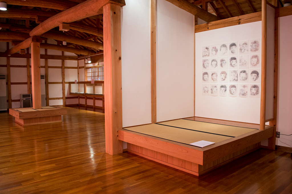
We finished up by spending about 3 hours poking around in the wonderful Intermediatheque museum. Photography wasn’t allowed and the website doesn’t give much of an impression of the place, so you’ll have to imagine somewhere that’s a cross between the Pitt Rivers museum and the Lapworth geology museum at the University of Birmingham, with something of the curatorial feel of the V&A.

The highlight for me was the man at the desk at the back of the 2nd floor trying to piece together a jaguar skeleton whilst happily chatting to visitors and challenging people to correctly match the articulating surfaces of a deer’s leg. He said it takes him about 2 weeks to prepare a skeleton and armature – you can see why!

The next day we went to see a group exhibition of some artists who work in metal and then I managed to convince my companion to join me at the Bicycle Culture Center [English language article] by telling her a bit about Kat Jungnickel’s Bikes and Bloomers research project and showing her my photos of the Bloomer Ride.

Bicycle Culture Center

Bicycle Culture Center

By this stage it was Christmas Eve and I relocated back to Yokosuka for more bears and also a second yuzuburo, although this time with more juggling and plastic turtles.

Yuzuyu two

For our Christmas party we took the Japanese’s adopted fried chicken, and added raw octopus, sushi cake and a kind of summer fruits pudding.

taco

sushi cake

Christmas cake

Our special guest of honour seemed to approve, and I have to say I also really enjoyed the blend of familiar and completely alien ingredients to the afternoon! We did however keep to the universal truth of the empty cardboard box being played with as much, if not more, than the present itself.

merii kurisumasu

I flew home a day and a half later.

~~~~~

I’m not really sure how to conclude this blog post – writing it has been a good way to remind myself of everything that happened, but I feel its only just the start of the process of digesting and reflecting upon it all. Maybe check back in with me in a few months’ time to see what is still in technicolour and what has faded?

In the meantime, many, many thanks to everyone who hosted me, taught me, laughed with me, or just took a chance on saying hello.

The photos here are all released under a CC by-nc-sa license, with larger sizes of the originals (and many more) to be found over on Flickr in this album. If you want to skip the Playable City workshop photos, then start about halfway down this page.


Playable City Tokyo

Playable City Tokyo

I was recently one of four British participants selected to take part in Watershed’s Playable City project in Tokyo. Working alongside 7 Japanese counterparts and an awesome support team from the Pervasive Media Studio and British Council Japan, we spent a week exploring the theme of playful welcomes:


In 2020, the world will focus on Japan for the Olympic and Paralympic Games. In the run up, the construction period and during the games themselves, thousands of people will visit the city who have not been before. With the theme of  a ‘Playful Welcome’, seven Japanese and four UK participants will collaborate and develop playful ideas to connect visitors and local people to each other and to the city, during this exciting time.

…The Playable City Tokyo 2016 Creative Lab and Forum programme is part of the trial research project for the governmental “Basic Policy for Promoting Measures related to Preparations for and Management of the Olympic and Paralympic Games in Tokyo in 2020”.

Further details about who was involved can be found on the Lab’s page on the Playable City website.

It was an intense week with a lovely group of intelligent, observant, generous people all riffing off each other and their surroundings; poking at gaps in language and disjoints between cultures, asking many questions and exploring even the smallest of details alongside the big questions.

Some of the very many things we packed into that too-short amount of time included some of the following…

Looking up

A map-making exercise of the area around the WIRED lab in Ark Hills where we were based. These maps led us to complete creative activities, to seek out the deity hidden in plain view and to chase after leaves. The one I made was effectively a prompt for people to slow down and to look up: a sort of treasure hunt of details and views.

Looking up

We also concocted small games for each other. Jo and I were set the Chopsticks Challenge which comprised several tasks that had to be completed working together elbow-to-elbow to make a pair of chopsticks with our forearms. I’m quite impressed with our portrait of Hilary!

chopstick drawing

As the week progressed we were allocated to different teams and we began the task of a more focussed critique of Tokyo and the processes of interaction and integration we might like to see happen as visitors start to arrive as part of the upcoming Olympic Games.

group sharing

We filled many ginormous sheets of paper with notes and diagrams like this:

thinks

(I can assure they all made perfect sense at the time!)

Gradually the concrete room we were colonising became covered in the traces of our thought processes and we began to distil out key themes and assemble them into a proposal for things-that-might-be.

With limited time and resources, prototyping was very lo-fi …but fast, and full of energy. Also little magic moments like this demonstration of a restaurant queue enlivened into a collaborative dance routine by responsive light panels in the floor!

magic moment

Other experiments took place outside.

We only got into trouble with the local security guards twice in the whole week…

trouble

As our ideas got bigger they also started to ask more questions about the types of interactions we wanted to nurture, the places we wanted these interactions to happen and how we wanted to mediate these.

Our group repeatedly grappled with the ideas of gateways, rabbitholes and entrances, so when it came time to take our prototyping outside to include real people and places, we chose to take things right back to basics and to do some experiments questioning how the very first invitation might work. What does it take to bring someone over that line between playing and not playing?

To focus in on the invitation we had to choose play that was familiar enough that we wouldn’t need to explain the rules. One thing led to another and suddenly we were armed with a selection of signs and an escalator in the nearby shopping centre.

pick one

Our aim was to use the fixed space and timespan of the journey up the escalator as a space in which to recruit people to playing a game of Rock, Paper, Scissor (or Janken Pon) at the moment that they reached the top.

janken escalator

We tried different signs in the approach to the escalator and also on and alongside the escalator itself, but without much uptake at all. It wasn’t until we ‘rebranded’ the escalator as The Janken Escalator that things started to turn around.

Perhaps not at all unsurprisingly, the real change came when we had a person waiting at the top of the escalator, ready to start throwing shapes. Up until then we’d had a poster with a pre-made choice that the player ‘played’ against by making their choice – and grabbing a piece of paper representing it – on the way up.

Playing with a real person is just loads better!

(c) British Council, photo by Kenichi Aikawa

© British Council, photo by Kenichi Aikawa

Again I think we raised as many questions as we answered, but that’s when you know things are interesting. Alas we were out of time, though, and the following day we were presenting our research to a room full of people before wrapping up and saying our goodbyes.

traces

Also traces

You can see my Flickr album of photos from the workshop here: https://www.flickr.com/photos/nikki_pugh/albums/72157673973684273

It was a wonderful, challenging, stimulating workshop to have been a part of and it’s left me hungry for more of the same. It’s also been interesting to have had the work flow structured by someone else – making me reflect on the processes I would normally work though and highlighting aspects that I find more or less important to me in my practice. For example, in particular I felt the lack of having a specific place to be designing interactions for. What was interesting though was that I also felt the lack of having a technological system to work with too.

Normally I’d be reciting a mantra of “don’t start with the technology”, but Playable City is ultimately about being playful with the infrastructure of a place (rather than just being playful in a place) and it felt like that was missing a bit from the ideas we explored.

I wonder both how I would approach the brief if I tackled it by myself, but also how we would build on what we did in that one week if we tackled it again as a group.

I think even if I did do a solo project I’d be carrying the Playable City cohort with me: my perception of Tokyo is now mediated through the eyes and experiences of everyone in the group and the things that they shared.


Orrery: a prop for conversations

Having made the Orrery, the next step was to send it out into the world and see where it could take us in terms of conversations and approaching the idea of live-tracking a bit differently.

First it visited Emily Chappell and her dad; then I went for a bike ride with Hannah Nicklin, revisiting some of her triathlon route; and then the Orrery caught up with Tina Tylen and Bumble the dog as they waited for Kajsa to return home. I also spoke about the Orrery at the recent Pedalling Ideas event in Leeds, and conversations there have filtered into the mix as well.

For the exhibition at Wolverhampton Art Gallery I made an audio piece (you can listen to it via the thingy above, or download it via this link), which weaves together some of the themes that came out of all these discussions. It’s kind of a snapshot of what the conversationalists and I have been thinking about recently, looked at through the lens of the Orrery for Landscape, Sinew and Serendipity project. This part of the process has also been the sort of initial brainstorming phase for understanding what the Orrery is …or what it might be.

I’m keen to explore different types of watchfulness relating to cycling journeys, especially those that aren’t served by the sort of live-tracking tools currently in use. Get in touch if you have a story you’d like to share.

Links for things mentioned in the audio:
The blog accompanying Hannah’s development of Equations for a Moving Body
Emily’s blog post about her ascent of Mount Ventoux
Kajsa and Tina’s video diary of the record attempt


orrery

relating

remembering


return

Sketch from Pedalling Ideas event by Phil Dean (@PHILDEAN1963 on Twitter)

Sketch from Pedalling Ideas event by Phil Dean (@PHILDEAN1963 on Twitter)


Orrery for Landscape, Sinew and Serendipity: Wolverhampton exhibition

Orrery for Landscape, Sinew and Serendipity will be exhibited alongside the Wolverhampton School of Art MA show taking place at Wolverhampton Art Gallery between the 1st and 9th of October. Full details here: http://www.wlv.ac.uk/mashow/

Below is the text I wrote to accompany the moving Orrery (playing back sections of four different rides) and the audio of conversations between myself of Hannah Nicklin, Emily Chappell and Tina Tylen.

Orrery detail

Orrery for Landscape, Sinew and Serendipity is an ongoing project that asks questions about the physical and emotional experiences of cycling, the physical and emotional experiences of being the person left at home, and the frictions of data visualisation.

Various live tracking services exist that enable you to ‘watch’ cyclists as they make their journeys. Usually this involves a web page showing a map, a marker icon representing the person pedalling and maybe a line showing the route they have taken so far. Known as ‘dot-watching’, following the progress of riders in this way is highly addictive and—along with social media—is a big part of the audience’s experience of events such as the Transcontinental Race (Belgium to Turkey via various mountainous checkpoints) or the Tour Divide (Canada to Mexico along the Rocky Mountains) as well as individuals making record attempts.

Working from the starting point that the tools we use tend to influence the way we think and talk about things, Nikki has made the Orrery as an alternative to dot-watching in order to use it as a prop for conversations about the tools we use already and how different tools might open up different avenues of thought.

A physical object with elements that are raised, rotated, rattled and illuminated, the Orrery is driven by the same GPS data as the map-based tracking websites, but rather than showing us where the rider is, how far they have gone and how fast they are moving, it instead conveys something of the moment-to-moment experience of being on the bike. Is the rider struggling up a hill, experiencing an exhilarating descent, battling a headwind or immersed in the arriving dawn?

Here the Orrery is accompanied by audio from conversations between Nikki and Hannah Nicklin, Emily Chappell and Tina Tylen.

Last year Hannah competed in an Ironman distance triathlon (a 2.4 mile swim, followed by a 112 mile cycle and a 26.2 mile run). Nikki and others gathered online with bated breath, hitting refresh on the results page and waiting for news that she’d made it around the course after some 14 hours.

Emily is known for doing big adventurous bike rides and for writing about them. After an aborted attempt in 2015, this year she completed the Transcontinental Race in 13 days, 10 hours and 28 minutes. Her father’s spreadsheets of her rides form a counterpoint to Emily’s experiences of dot-watching and of being the dot that is watched.

Tina is the mother—and the support crew—for her daughter Kajsa as she attempts to break the women’s year record by cycling more than 29,603 miles before the end of 2016. Tina watches Kajsa’s dot to gauge if all is well …and to check if there’s enough time to nip out to the supermarket before she gets back.

Inevitably this is not a project about data or electronics or even bikes, but about connections between people.

The Orrery is replaying sections from the following rides:
Mark Chappell // Wind Farm and Wild Dogs. (1 hour 25 minutes)
Kajsa Tylen // Starting Out. (1 hour)
Emily Chappell // The Gradient and the Effort and Everything That’s Gone Before. (1 hour)
Hannah Nicklin // Horrible Horrible Rain and Wind. Freezing. (1 hour)

Orrery detail

Orrery detail

Orrery detail

Orrery detail

Supported using public funding by the National Lottery through Arts Council England.

Also with thanks to:

  • Mike Cummins, Jez Higgins and Kim Wall for programming skills.
  • Phil Smith (Enginuity) and uMake for fabrication facilities.
  • Emily Chappell, Mark Chappell, Hannah Nicklin, Tina Tylen, Kajsa Tylen and everyone else who has contributed brains and/or brawn to the project.

Links & Shifts

Links & Shifts was the event I instigated to accompany the Orrery for Landscape, Sinew and Serendipty project. Hosted at BOM it took place on the 21st of August.

Many thanks to everyone to came and took part. Text and photos from the event below…


Nikki Pugh in conversation with Kat Jungnickel and Emily Chappell.

Practitioners from three different disciplines explore the similarities and differences in their working processes. The obvious link between them is cycling, but this event will delve deeper into methods of understanding-through-doing; the affordances of bodies and technology in motion; and how we tell the stories of the physical, emotional and intellectual journeys we go on.

Nikki, Kat and Emily will each give a presentation about whatthey do before then taking part in a group panel discussion that takes a closer look at how and why they do. There’ll be tea, cake, books, bikes and bloomers during the break.


Nikki Pugh

Artist Nikki Pugh investigates interactions between people and place. Recent projects include a research and development residency at Coventry Transport Museum thinking about collective storytelling of experiences relating to cycling and different cycling cultures, and a cycle guided tour in the form of a treasure hunt for adrenaline, serotonin and oxytocin.

Links & Shifts is part of a larger project in which Nikki asks the question “What happens when you change from thinking about markers on a map to an awareness of the changing rhythms of effort and terrain?” and attempts to answer it by building an Orrery – an alternative approach to the visualisation of cycling data involving a moving sculptural object rather than dot-watching on a webpage.


Kat Jungnickel

Sociologist Kat Jungnickel has been researching the social, political and material challenges to the freedom of movement experienced by Victorian women. The resulting research – Bikes and Bloomers – has at its core the making and wearing of a collection of transformable cycling garments patented at the time.

Put yourself inside the research: Kat will be bringing along a selection of the garments which you will be able to try on. We’ll also have a vintage bicycle rigged up for you to sit on and pedal so you can get a sense of what it might have been like to ride in clothes like these.


Emily Chappell

Adventure cyclist and writer Emily Chappell has toured across continents, fatbiked across snow and ice, and raced across Europe. She recently published a book about her time as a cycle courier in London and regularly writes for the Guardian’s Bike Blog.

Emily will be recently returned from racing something in the order of 3,800 km (2,360 miles) between Belgium and Turkey. Join us for the post-race stream of consciousness where memories start to be shaped into stories, links are made and the process of reflection gathers momentum. New endeavour The Adventure Syndicate pledges to show “how it works from the inside”, so expect that to feed into our conversation too.

Copies of What Goes Around – Emily’s memoir of her time as a London cycle courier – will be available to buy for £13 each and Emily will be signing books during the event. (If you’d like to buy a copy, please register before the 11th of August.)

Photos thanks to Pete Ashton, full album on Flickr

Links & Shifts

Links & Shifts

Links & Shifts

Links & Shifts

Links & Shifts

Links & Shifts

Links & Shifts

Links & Shifts

Links & Shifts

Links & Shifts

Fermynwoods residency: mapping foxes

The fields next to where I’m staying were mown last week: first the cut grass lay in striking stripes, then it got rolled up into bales.

28355398113_361f965c28_z


28939453936_22febe2908_z

At this point I saw my opportunity to walk through the middle of the field, rather than skirt the edges as I normally would to avoid damaging crops. On a dusk meander, I had a bit of an explore and spotted a few dark green tracks in the cut grass.


28352654684_8573c68d3a_z

At that stage I wasn’t entirely sure if they were animal tracks or perhaps a tell-tale of a pipe or something, but I saw a few more – even more wiggly – and then a while later I encountered these two:

foxes

Later that night the bales got cling-filmed  – a surreal process I only saw glimpses of from the other side of the field, illuminated by tractor floodlights. I had to look it up. Here’s what I think was happening:

Anyway, now the field is bedecked with plastic blobs:

28988371736_073d5be273_z

And, yep, the tracks are still there and I started noticing more of them as I walked in the field a few more times.

29022263685_53fb803ced_z 28423812063_bf4b32a522_z

Yesterday I reached a point where I knew I had to investigate further. I wanted to know how many tracks there were, where they went and how they related to each other. The field undulates quite a bit, so there’s not a convenient vantage point where you can do this just by standing in the tight spot and just looking. Yesterday I reached a point where I knew the only way to investigate further was to walk all of the trails and track my movements using GPS.

29008405106_9b1984d63a_z

I’ve just read the chapter in The Old Ways where Robert Macarlane is trying to locate and then follow a shieling path across the peat moorland and rocky mountain slopes of the Western Isles. Both surfaces in their own way resistant to bearing traces of footfall, the path is marked with small cairns of rocks arranged at intervals. It takes him a few hours of searching to find the path, following the instructions he’s been given:

“When you’re up there you need to look for what shouldn’t be there: two or three pale stones aligned, the rock that has been displaced, that isn’t where the ice and gravity should have left it.”

And then:

“Click. Alignment. Blur resolving into comprehension. The pattern standing clear: a cairn sequence, subtle but evident, running up from the Dubh Loch shore.”

I was particularly thinking of this as I walked around the field because it turns out the trails can be devilishly hard to spot sometimes. There are the main tracks – dark green with long grass pressed flat enough by many feet that it has escaped the mower – easily visible as they snake across the field, however the lesser used trails are less obvious. I found that a lot depended on what direction they were going in relation to the sun, and where I in turn was stood in relation to that. Looking in one direction the trail could be practically invisible, yet really obvious when viewed from the opposite direction. In some cases it took a certain amount of voodoo to intuit where a trail went, then walking out to a complementary vantage point, looking back and checking that that was the right way to go.

I suspect my task might have been easier had I done it later in the day when the sun was lower, but I wanted to be done before dusk so as not to disturb the foxes too much. They’ll already be disgusted at the horrible human smell that’s all over their field!

Screen Shot 2016-08-17 at 10.28.00

I walked for 3 hours and covered about 5 miles walking backwards and forwards, tracking the trails and retracing my steps to go back to each junction.

I’m sure I must have missed out some branches, as it was very difficult to *ahem* keep track of everything, but I feel like I’ve now got some sort of sense of how they all fit together and how they relate to the geography of the field.

Here’s the final trace superimposed onto Google’s satellite view of the area. I like the juxtaposition between these lines and the regular ones made by the tractor working the adjacent field.

Screen Shot 2016-08-17 at 10.22.37

Close to 3 miles worth of network.

What’s it like to navigate those paths?

How much learning does it require, and how much can you sense the current state of the paths and their users?

How do you keep track of where you are and which turnings you have to take when these trails are tunnels within long grass?

How do these trails link up to their counterparts in the woodlands?


Copyright and permissions:

General blog contents released under a Creative Commons by-nc-sa license. Artworks and other projects copyright Nicola Pugh 2003-2024, all rights reserved.
If in doubt, ask.
The theme used on this WordPress-powered site started off life as Modern Clix, by Rodrigo Galindez.

RSS Feed.