By Duddon’s Side – the exhibition

The By Duddon’s Side exhibition was installed at the Wordsworth Museum in Grasmere and ran from the 8th of April through until the 25th of June.

Duddon installation

Duddon installation

Inside the cabinet we were lucky enough to be able to display some original documents from the museum’s collection, as well as some other objects relevant to the theme of re-visiting the sonnets. The exhibition also included some documentation of my residency, presentation of some of the responses from participants to photographs by Herbert Rix (also on display), and the two artworks I produced from my residency.

Duddon installation

Participants had been out and about around the Duddon Valley seeking out the contemporary views that matched the locations in Herbert Rix’s photographs. We laser engraved some of the photos people shared with us and presented them on a map with other observations made about the process.

Duddon installation

Duddon installation

Duddon installation


Duddon installation

Next to this was a touch-reactive sound wall, accompanied by a rather magnificent loaned handbuilt kayak. Wooden icons represented different locations along the River Duddon and, when touched, triggered an audio recording from that place.

Duddon installation

Duddon i

Duddon installation

Duddon installation

The reactions from people – even as I was still installing it – were great. The best response to “but why is it awesome?” was “BECAUSE IT MAKES ME FEEL LIKE A WIZARD!”

The egret from the estuary proudly bears some grubby finger marks from when, during installation, I invited a couple of kids over the barrier to help me with some ‘essential user testing’!

Duddon installation

The stepping stones (based on digital 3D models of actual stones across the Duddon) were popular as well, once people understood that they were intended to be played on. Focusing in on four lines from one of the sonnets and an account from the Reverend Malleson of his retracting of the sonnets’ journey down the Duddon, the stones were there to invite some “not unpleasant peril” within the gallery.

Duddon installation

Duddon installation

Duddon installation

Duddon installation

Duddon installation

Duddon installation

A fifth stepping stone went to the Peter Scott Gallery at Lancaster University and was exhibited as part of their OPEN programme of events.

More photos of the exhibition at the Wordsworth Museum can be found here.

Wooden stepping stones

This post was originally published over on the By Duddon’s Side project blog: http://byduddonsside.wordpress.com
~~~

Having photographed the stone stepping stones and transformed them into digital stepping stones, the next task was to  turn them into wooden stepping stones.

I did this thanks to the skills and CNC routing equipment at the FabLab in West Bromwich where the manager Anne helped me to turn a few sheets of plywood into some contour model versions of the stepping stones.

Lots of photos…

After cutting the shapes out of the wood, I then relocated to my local open access wood workshop where I assembled the stones and began the task of applying as many coats of yacht varnish as I could within the time limit.


Digital stepping stones

This post was originally published over on the By Duddon’s Side project blog: http://byduddonsside.wordpress.com
~~~

And this is the reason why I was taking hundred of photos of the stepping stones from all angles.

Using a process called photogrammetry, the photos can be recombined to form digital models of the rocks. Tim from Backface Studios in Birmingham was kind enough to provide the skils and the computer processing power to generate these models from the photos I took.

Look at the detail! Even the little pools of water in the crevices on the top of the rock!

Here are the links to the 3D models online so you can spin them around and zoom in as you wish:

https://sketchfab.com/models/ce0a1fcad3d340e68315aeeca5cf8d04#
https://sketchfab.com/models/dff19e5ce66a409a91262e859c1356c1#
https://sketchfab.com/models/440741dc28674fdba0e8e0f682e6004a#
https://sketchfab.com/models/77e7776c4e3d42f99d9862086df755b4#

I really like the splooshes and splashes of the water captured around the base of the rock, partially because I’m not sure if they are a single, frozen moment, or some kind of amalgamation of all of the splashes from all of the photos. The other reason I like them is because of the good shapes – this first one really reminds me of the The Great Wave off Kanagawa print by Katsushika Hokusai.

Nice as these details were, these weren’t the reason I wanted the digital models of the stepping stones. The surface colours got ditched, the bottom bits got trimmed and tidied up, and then everything got sliced up.

The purpose of all this was so that I could remake the stones and place them in the gallery. Part of my brief for the exhibition is to make it more of an embodied, sensory experience, to complement the somewhat text-heavy approach of some of the other spaces visitors will have encountered.

I read a lovely description from the Reverend Malleson (1819-1879, vicar of Duddon-in-Furness) from when he tried to follow in the footsteps of Wordsworth and made his own journey to locate the landmarks described in the sonnets. He described the act of crossing the river via the stepping stones near Seathwaite as being a “most welcome and delightful way of not unpleasant peril” and I reckon not unpleasant peril would be something rather nice to introduce into the gallery space!


Wordsworth’s steps from all angles

This post was originally published over on the By Duddon’s Side project blog: http://byduddonsside.wordpress.com
~~~

steps scan

So, why did I spend an hour stood knee-deep in a very cold Lake District river?

Various people have tried to assign specific locations to the different places described in Wordsworth’s Duddon sonnets. Some are easier to locate than others and, whilst the mention of stepping stones in the tenth sonnet sounds like it should be a pretty straightforward place to identify, there are a lot of stepping stones across the Duddon, and, well, long story short: we still don’t really know.

These ones at Wallabarrow near Seathwaite seem to have won out by general consensus, possibly because they’re often regarded as the most scenic.

Not that you could tell so much when I first went to see them: there had been a lot of rain, the river was high and fast as a result, and I nearly didn’t spot them at all when I got down to the river.

After a bit of hesitation and selecting a run of stones where the water was slightly less deep and treacherous looking around them, I girded my loins and got into the river.

Brrrr it was cold!

Also nice and slippery thanks to the green slime on the loose pebbles on the river bed!

Fortunately I managed to stay upright and completed my task of taking lots of photographs of the stones from all angles. What I forgot to do, however, was to take any measurements of the stones so I had a scale reference for the photos, or to take enough photos of the relative positions of the stones.

“No problem!”, I thought, and popped along the next day with a measuring tape.

Oh!

That’s the thing about the river: it’s not static. The water flows along its length, but there’s also movement up and down on a daily basis according to the rain and ground water. You can experience a different Duddon on consecutive days.

Below are some photos taken a few weeks later, just as Spring was starting to be hinted at in the valley. You can see the gentle curve of the stones that people find so pleasing and they look more like a reasonable path across the water.


Sources

This post was originally published over on the By Duddon’s Side project blog: http://byduddonsside.wordpress.com
~~~

Monday was an absolutely gorgeous day …which was fortunate, because I’d agreed with one of the new Wordsworth Trust trainees that we’d spend a big chunk of it in the valley and, as this was to be her first time in the Duddon, that of course meant the Wrynose!

Look at it!

Sort of a source

I wanted to try making some audio recordings at various points along the river, so after a look at the Three Shires Stones we walked along the bridleway for a short time and then peeled off to follow a promising looking stream.

Sort of a source

Above: looking downstream.

Sort of a source

And this little gully is what we found! It seemed to represent the source well enough (even though it almost certainly wasn’t) so I set up my recorder in what I hoped would be in the lee of the wind, pressed record and hoped for the best. It’ll be a while before I get a chance to listen to the audio on half decent speakers and get a feel for how bad the noise from the wind is, but this will be a useful test.

Sort of a source Sort of a source

Wrynose Bottom

I’d like to explore that knobbly fell more – maybe following the bridleway further or having a more determined effort at following one of the streams up to its source.

Wrynose Bottom

Wrynose Bottom

Meanwhile, we had to continue our journey along the valley.

There was time enough for another audio recording a little further down Wrynose Bottom, again needing me to be resourceful (or perhaps foolhardy) with trying to place the recorder in a sheltered spot where it would pick up the sound of the water.


not in fact Dale Head steps

not in fact Dale Head steps not in fact Dale Head steps

Or next stop was the stepping stones at Dale Head.

At least that’s where I thought we had stopped: it wasn’t until we were back home and I was able to compare map with our GPS track that I realised we were at the next steps down.

Above Birks bridge Above Birks bridge

Birks bridge

Anyway, that explains why, when we parked at the Birks Bridge car park and walked up alongside the river, we couldn’t then find the next set of stepping stones – we’d already been to them!

I tried another audio recording whilst stood in the river, but I suspected the wind noise would be too much, so we made our way back to the car and I tried again downwind of the bridge.

Next on the itinerary was the ruins of the Iron Furnace near Duddon Bridge. Unfortunately there has been some collapsing recently, so there is no public access to the site and we had to content ourselves with photos from the footpath. Fortunately a decent zoom on my camera meant that I could later read what the information panel says! All but the very bottom lines, anyway!


Duddon Iron Furnace

Duddon Iron Furnace

I’d have loved to have had a closer look at the buildings but, having seen where one of the doorway lintels was starting to disintegrate, I think closing the site was the only choice. Oh well.

As well as the photo of the information panel linked to above, there’s also an interesting description on the Historic England website.

I’m still trying to comprehend how much wood was needed to produce the charcoal to feed the furnace. I’m really curious about what the charcoal kilns would have looked like and how that area must have smelt: burning wood and burning metal. The two seem to come together in the name Furnace Wood.

cakes and local history

Our final stop for the day was at The Square Café in Broughton-in-Furness. Here we met with the group of participants that Chris (Lancaster University) and Jeff (Wordsworth Trust) had been working with using some photos of the river as a starting point.

We didn’t talk so much about the photos in the end, but there was some fascinating conversation about how people had arrived at the Duddon Valley, what their connections were to the landscape and what life was and had been like there. More on that later after I’ve had a chance to digest it a bit more, I expect.

cakes and local history cakes and local history

cakes and local history

The conversation also seeded some ideas for how to move forward with the project, so I’m also trying to process those and try and give them a bit more shape.

CeMoRe walking seminar

This post was originally published over on the By Duddon’s Side project blog: http://byduddonsside.wordpress.com
~~~

My residency exploring the Duddon is part funded by the Centre for Mobilities Research at Lancaster University, and as part of my visiting fellowship with them I instigated a walk around an area of the Dunnerdale Fells.

Below are a selection of photos from the walk, more are over in this album on Flickr.

It wasn’t a guided tour as such, more an opportunity for people from various backgrounds to gather and to use the act of walking to observe and comment differently on the landscape.

A great mix of people came along, including artists, mobilities researchers, students and someone from the management school. (This is one of the things I like about Mobilities Studies – that it can bring in people from lots of different disciplines.)

CeMoRe walking seminar around Dunnerdale Fells

Our initial introductions were hampered slightly by the fairly substantial climb right at the beginning, but we gradually got to know each other over the course of the following 4 miles or so.

CeMoRe walking seminar around Dunnerdale Fells

The weather was cycling through a selection of different settings, althoug thankfully rain and fog weren’t on the menu and our hard work was rewarded with some stunning views and dramatic changes in light.


CeMoRe walking seminar around Dunnerdale Fells

The immediate terrain also gave us plenty to think about as we negotiated a selection of bridleways and footpaths, sometimes requiring us to cross becks and other boggy bits.

CeMoRe walking seminar around Dunnerdale Fells

CeMoRe walking seminar around Dunnerdale Fells

The stone sheep fold (and nearby contemporary galvanised metal sheep feeder) were a bit of a jarring human presence up on the fells, just as we were starting to relax into the isolation.


CeMoRe walking seminar around Dunnerdale Fells

We followed deep tyre tracks for a short while, but our attention here was more focused on the incredibly strong winds as we went over a particularly exposed ridge.

CeMoRe walking seminar around Dunnerdale Fells CeMoRe walking seminar around Dunnerdale Fells

Oh, but the views though!

CeMoRe walking seminar around Dunnerdale Fells

CeMoRe walking seminar around Dunnerdale Fells

Stickle Tarn elicited a few exclamations along the lines of “Wow! Brilliant!” as we rounded a corner.

CeMoRe walking seminar around Dunnerdale Fells CeMoRe walking seminar around Dunnerdale Fells

We decided up here was probably going to be the most sheltered spot we were going to find and so we settled down (briefly) for our lunch. We didn’t linger for long though, as it was bitingly cold and we were starting to feel the need to be moving again.

CeMoRe walking seminar around Dunnerdale Fells CeMoRe walking seminar around Dunnerdale Fells

Our opportunity to warm up came with the very steep scramble up to the top of Stickle Pike  (seen from the other side in the photo below). The payback came in the form of views right out to Duddon Sands and the estuary.

CeMoRe walking seminar around Dunnerdale Fells

CeMoRe walking seminar around Dunnerdale Fells

Circling back around in the direction of Great Stickle, Tess (previously a Geology student, but now working towards a PhD in Art) taught us about how quartz tends to be found alongside other ores.

CeMoRe walking seminar around Dunnerdale Fells CeMoRe walking seminar around Dunnerdale Fells

By the time we started to drop back down towards the floor of the valley, I’d also had conversations with people about guidebooks, how things get edited out of the record, Lord of the Rings, avatars and temperature, alternative formats for submitting work for assessment, and being the world expert on your practice.

Sadly I missed out on the conversation about the tapir.

CeMoRe walking seminar around Dunnerdale Fells CeMoRe walking seminar around Dunnerdale Fells

The last section of our walk followed the course of the Duddon back upstream, and there were appreciative noises all round at the change in surroundings. Pretty much we could all understand why the Duddon has a special influence on people.

CeMoRe walking seminar around Dunnerdale Fells

By this time I was nurturing a bit of a fascination for that moment when people leap across small streams, and managed to snap a few photos of jumpers in action.

CeMoRe walking seminar around Dunnerdale Fells

Shortly afterwards we had all made it back – dry – to the cars and then we relocated to the pub for a debrief chat about the things that we had noticed about the area and also about the effects of walking and talking at the same time as opposed to trying to cover the same ground whilst sat in a room somewhere.


A bike ride and a walk

This post was originally published over on the By Duddon’s Side project blog: http://byduddonsside.wordpress.com
~~~

After having read that Wordsworth recommended Walna Scar Road as the best way to enter the Duddon Valley, I’d been mulling over the idea of cycling over from Coniston. Poor weather, a bit of online research revealing it was more technical than I’d been imagining, and the resulting loss of confidence meant that I ditched that idea!

I ended up going over to the bike trails in Grizedale Forest, in part curious to see how many people were going to a place dedicated to a particular activity (I’ve been seeing hardly anyone as I explore the Duddon Valley, but have noticed there’s a fair bit of activity around places like Coniston and Ambleside.)

I got chatting to a couple who had traveled over from Leeds and we cycled together for a few miles. Having explained that no, I wasn’t local, but I was here for a couple of months for work, I then got onto talking about the project in more detail.

They’d done some canoeing in the valley several years ago and, unsurprisingly, it sounded very technical but also very rewarding, especially with some of the chasm-y sections.

As we stood in line for the bike wash afterwards, Jo started making a few links and suggested that she could get in touch with a friend who might have done some conservation work in the area. The magic phrase “otter survey” was uttered, and contact details swapped!

Grasmere

Back in Grasmere, I decided to explore the area near the Wordsworth Museum a bit, and walked around the lake. I’d forgotten how windy lakeshores can get, but it soon brought back memories of family holidays…

Satisfying to get back as night was falling, but just before it was dark enough to need a torch.


Ed’s nostalgic bits

This post was originally published over on the By Duddon’s Side project blog: http://byduddonsside.wordpress.com
~~~

Having resurfaced from our underground explorations, Ed took me for a walk around Penn and Ulpha Park – an area he knows well from his time living near by.

nostalgic loop

nostalgic loop

Starting from Loganbeck, we followed the track up alongside Park Moss, where there were signs of some interesting things going on with the forestry: one area where it looked like several trees had been toppled in what looked like a non-deliberate way, and then on the other side of the track this area which had been replanted and where the saplings were starting to show amongst the scrub and the reeds.

This was a nice contrast to the Frith Hall, where a few hardy trees had settled in amongst the ruins.

nostalgic loop

nostalgic loop

nostalgic loop

I was also struck by how the buildings tended to be nestled in up against the rocky outcrops. Here are some farm buildings that seemed to have been orientated on the same side of its shelter as Frith Hall was against its. Both were on the seaward side, which got me wondering about prevailing winds.

Castle Howe, wall and track

nostalgic loop

howe view

Next came Castle How: one of many in the area! This got us talking about globally unique identifiers, scales of localities and the different sources from which Cumbrian toponymy hails.

The far point of our walk was near the old bobbin mill. I didn’t manage to take any decent photos, but there’s a bit of an interview with one of the previous owners here.

Wooden bobbin for the textile mills of Lancashire used to be made at the mill until 1910. The raw material for the mill came from cutting lengths of wood from coppiced woodlands in the Ulpha district and working them into shape on lathes and coring machines. Water power had been used in the early days of the mill but a turbine had taken over in later years. The Millom News noted: “The first thing Mrs Cooper’s husband did was to instal his own hydro-electric plant, which is still running today and which the occupants of the Bobbin Mill would not be without. “The original beams of the mill are still intact but the millstones themselves had to be taken away during the last war in case they were used for grinding corn in defiance of the food rationing laws. “The rest of the mill has not changed much through the years and still retains some of its ancient charm in the ivy-covered stonework and curious chimney. “Nestling in the Duddon Valley, the Bobbin Mill is one of the few unspoiled reminders of yesteryear.

There’s also a contribution here that says the shaving from the mill were used to heat the local school!

nostalgic loop

nostalgic loop

Looping back round again, closer to the river, through Forge Wood and Low Park, there was more evidence of the foresters having been at work.

nostalgic loop

nostalgic loop

We also admired the work of the wallers, building up and over this boulder. This had been a sort of running joke throughout the day: the determination of the farmers to build walls up near vertical slopes, far away from the nearest roads. Also how the really large boulders had been incorporated into the build and roads wiggled to go between them. “Tell you what lads, why don’t we just leave this one here and go around it?”

nostalgic loop

nostalgic loop

I forget what this fungus is called, but they were un-nervingly rubbery to the touch and the resemblance of this one to an ear was so close it was very wrong!

Ed picked a few to take back home and cook with.

nostalgic loop

Before the rise up through Beckfoot and the last road section to return to the car we were treated to the sight of some lovely soft warm hues and the last of the low sun hit the other side of the valley.

That had been a very good day!

You can see an album of my photos over on Flickr, here.


Mines (dis)

This post was originally published over on the By Duddon’s Side project blog: http://byduddonsside.wordpress.com
~~~

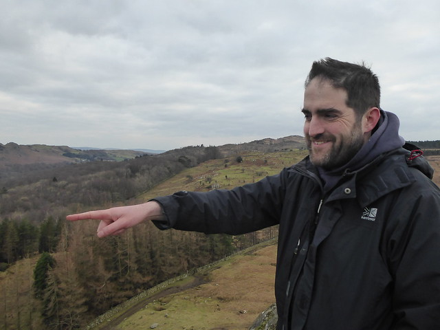
Yesterday I had the pleasure of being guided around the Duddon Valley by Ed. I’d only encountered him online up until now, but was pretty confident that he’d be able to reveal a different aspect of the landscape. I wasn’t wrong!

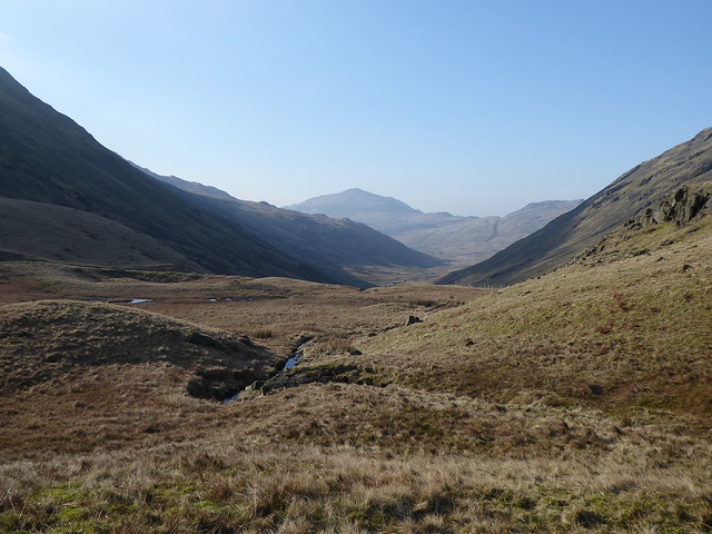
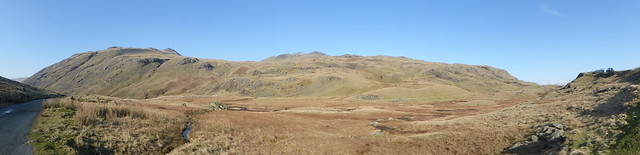
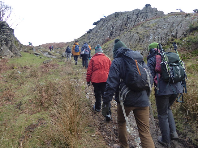
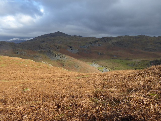
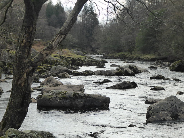
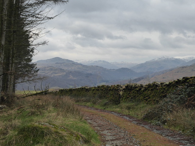
After an early morning start we headed out towards the Wrynose pass. On our way Ed pointed out the piles of stone on the side of the hill behind Little Langdale Tarn.

mining spoils

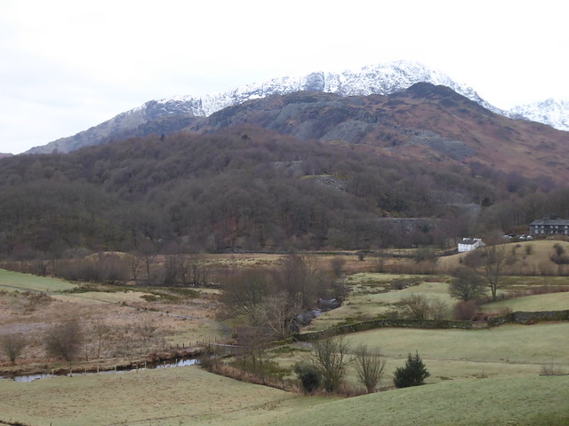
I’d dismissed these as naturally-occuring slate scree.

Wait, no, that’s not true: I’d probably not even registered them at all, just reading these and all the other piles of slate as ‘something you see in the Lake District’ and not given any thought to what they were or how they got there.

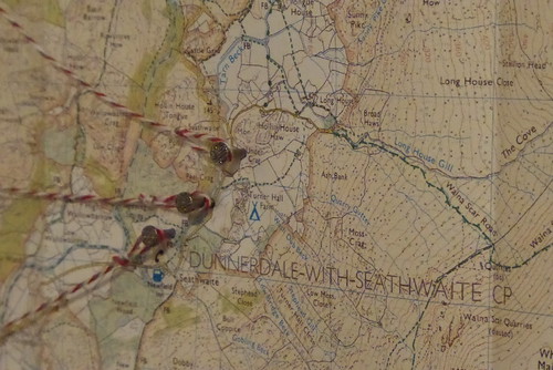
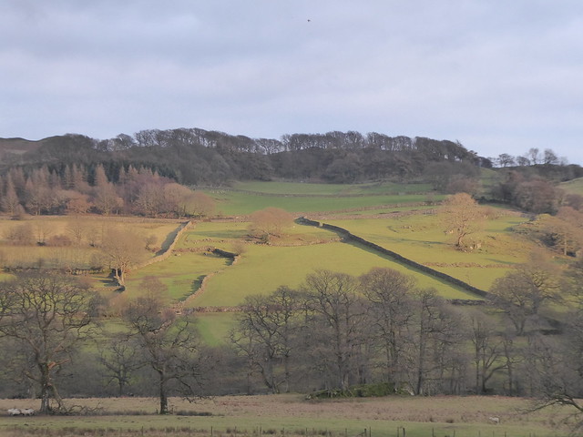
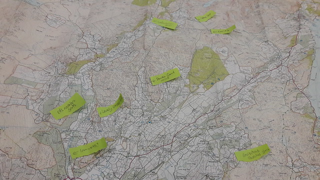
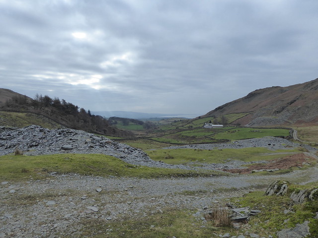
As soon as Ed pointed them out as being spoil heaps from quarries, I was suddenly looking at a whole new landscape. I mean, look at it! Look at all those quarries on that section of the map!

quarries

I’m assuming they’re all disused now. A bit of searching online suggests they were mostly active around the mid 19th Century – so Victorian times – probably not in full swing in Wordsworth’s time, but there would have been mining and quarrying taking place.

I’ve read about water-powered crushing mills, tramways and compressed air drills. Even if the stone and ore was still being bashed out by hand, can you imagine how different the soundscape must have been then compared to now?

Links: Wikipedia entryCathedral Cave | Greenburn copper mines

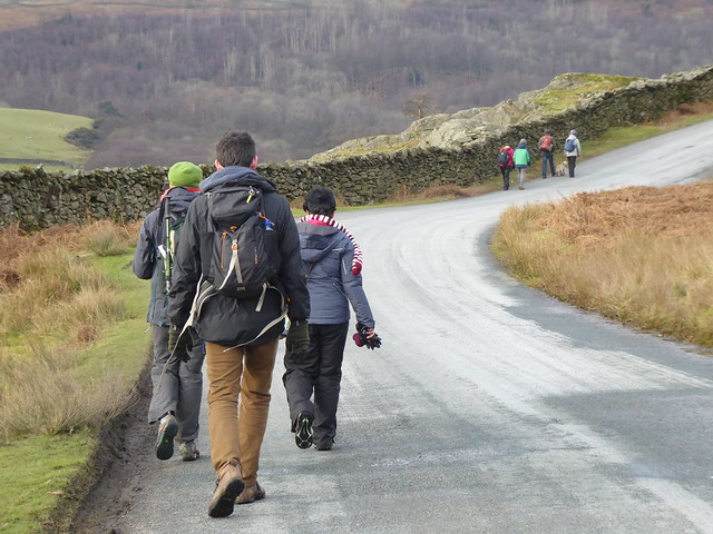
Towards the top of Wrynose we paused at the three shire stone. Initially confused by only Lancashire being represented on the carved upright, we then found the three flat slabs on the ground and had a bit of an “ah-ha!” moment.

County stone(s)

Source around here somewhere

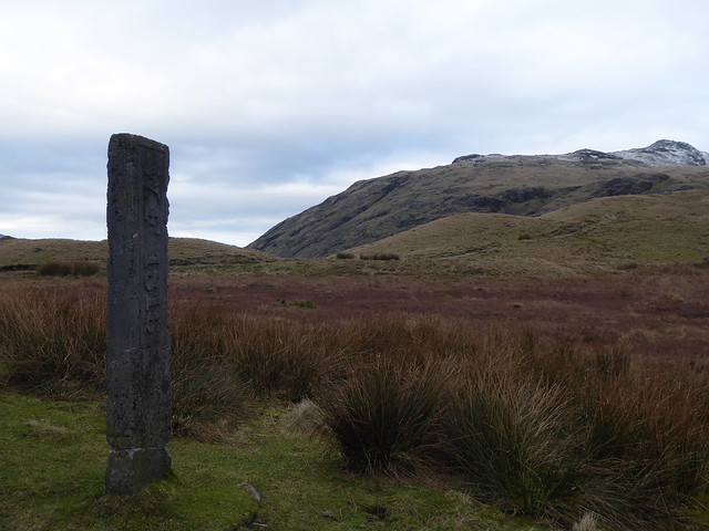
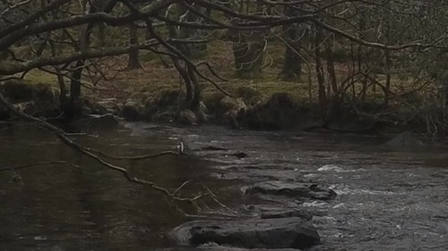
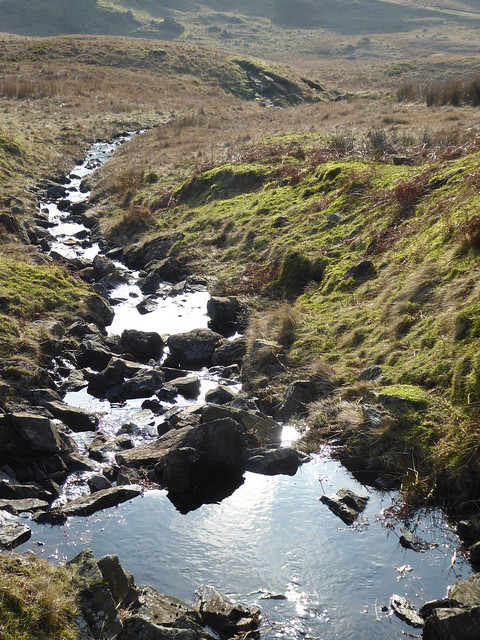
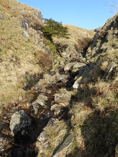
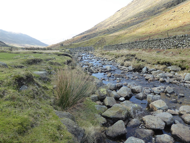
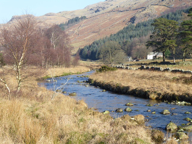
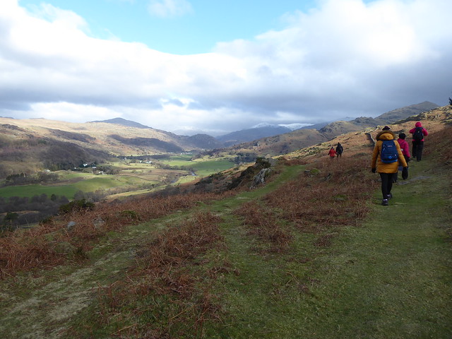
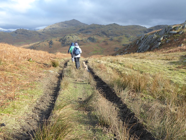
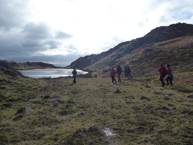
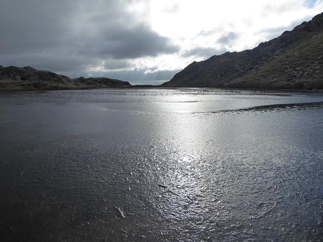
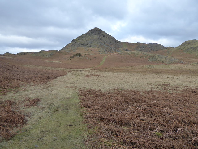
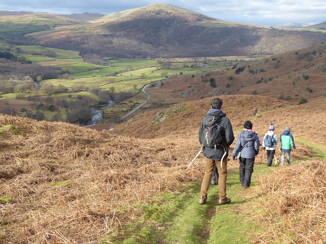
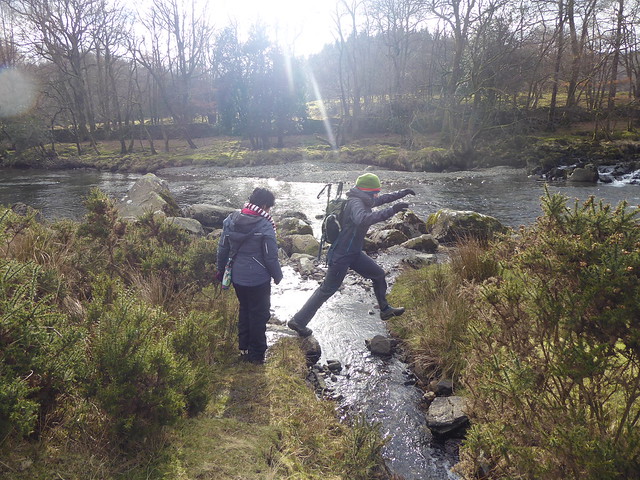
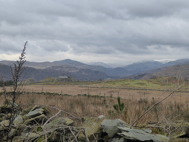
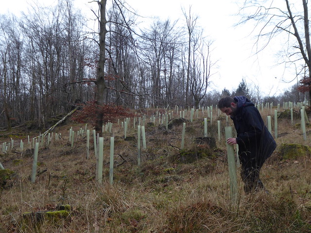
We paused just over the watershed and looked at several possible sources of the Duddon. We also looked at all the plastic tubes protecting tree seedlings. I’d made a few comments about February not being the best of times to be doing fieldwork in the Lake District, but Ed pointed out that it’s a lot easier getting about at this time of year compared to later on when all the bracken is up around waist height!

Duddon Valley

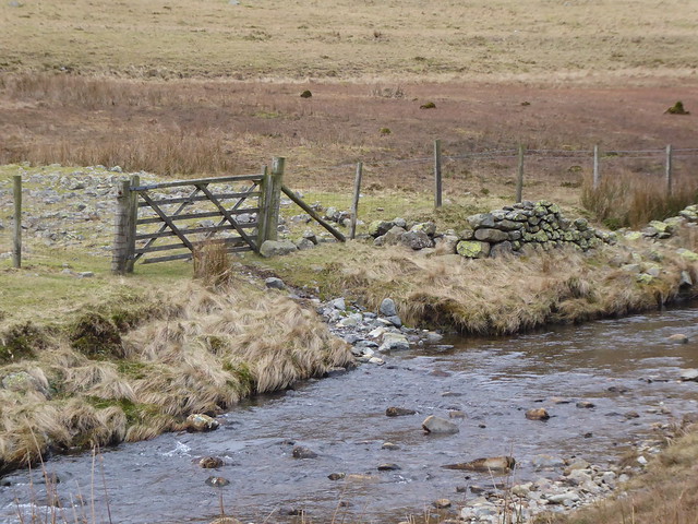
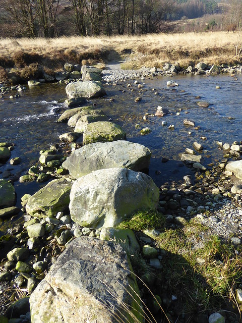
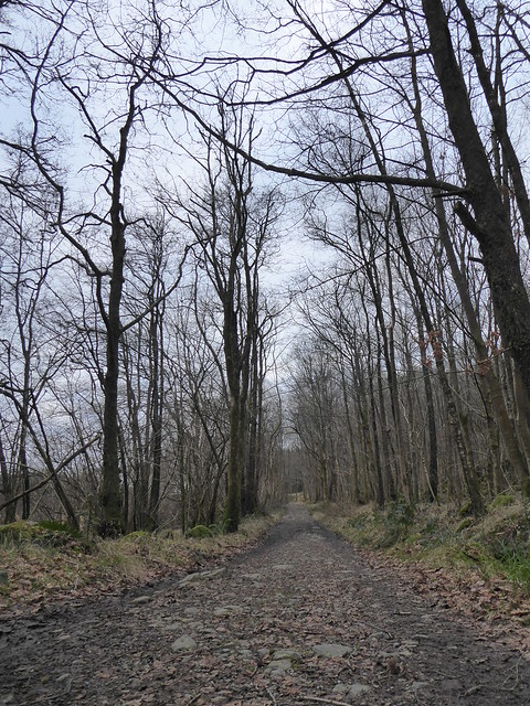
Thinking back to my earlier blog post about bridges, I snapped a photo of this track that has to contend with a gate and then a fording in quick succession.

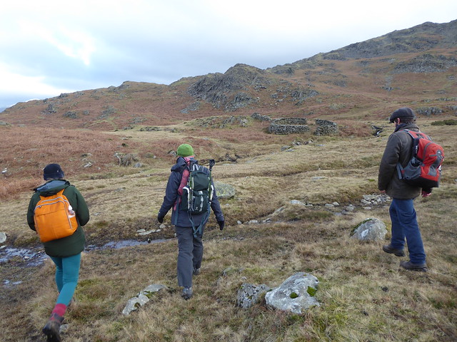
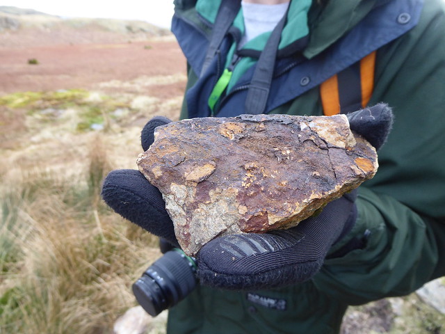
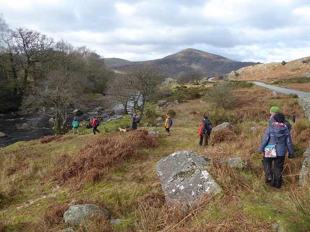
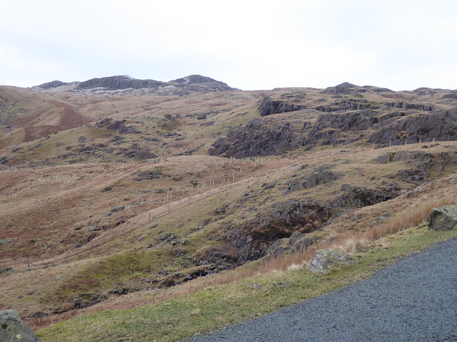
A while later we arrived up on Kiln Bank in the Dunnerdale Fells not far south of Seathwaite where our aim was to explore some of the abandoned mines.

Mines   Mines Mines Mines

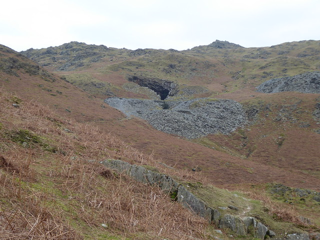
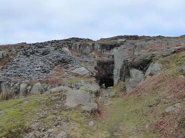
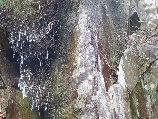
There was a bitterly, bitterly cold wind up on the top, so I was quite glad to get underground into the relative warmth of the caverns.

Ed was familiar with the mine, so was able to guide us through a series of about three connecting caverns. I imagine the miners (quarriers? quarrymen?) were following the rich seams of either slate or copper ore when they were digging here, so it shouldn’t really be a suprise to find that the caverns didn’t link together in an obvious way. Without Ed there, I don’t think I would even have realised there were passages leading out of the first space, since they weren’t visible from the ‘main road’ by the entrance.

Mines

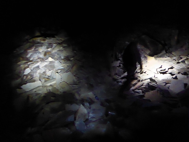
I regularly found myself dumbfounded by trying to imagine these as working quarries: finding it near impossible to comprehend them filled with people, machines and NOISE!

Mines

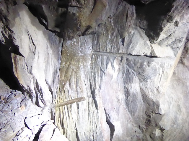
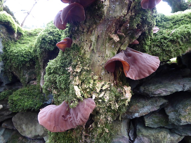
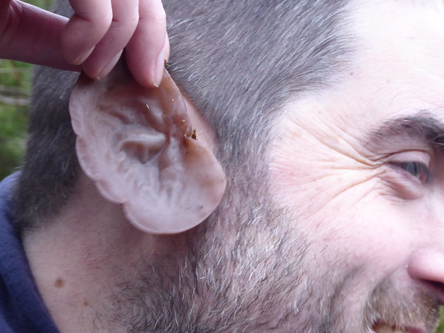
I mostly parsed the spaces as natural caves, but every so often there were drill holes like those above and then, for a moment or two, the spaces were undeniably manmade.

We had to be careful moving around on the loose slabs and scree, but the biggest hazard was the broken glass dotted around the place, as it turns out that, more recently, the caverns had been used as a hangout of some sort.

Mines

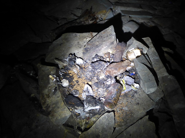
In the furthest back cavern we went into, we even found traces of a fire.

I’m curious about the quarry’s life as a place people would go to. Was it as a place to shelter? Did someone live here for a bit? Did teenagers come here to get their kicks? (It’s not the easiest of places to get to – they’d have to be fairly determined teenagers!) Perhaps it was older thrillseekers, or just those wanting to get away from things for a while?


Mines

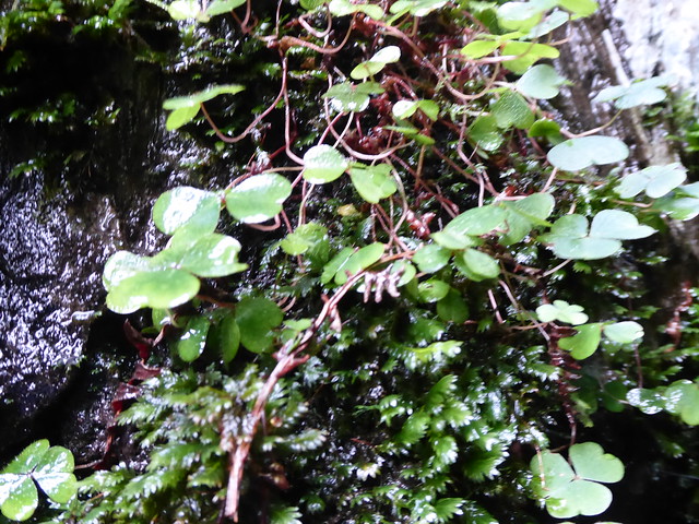
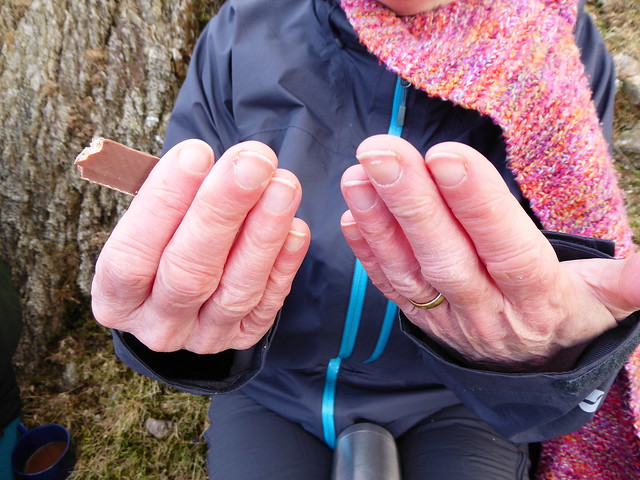
Back up on the surface, Ed had a nibble on some wood sorrel he found growing near one of the mine entrances.

Duddon Valley

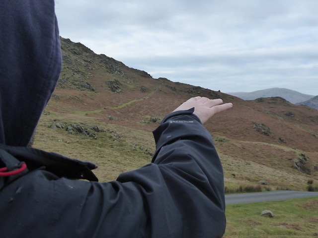
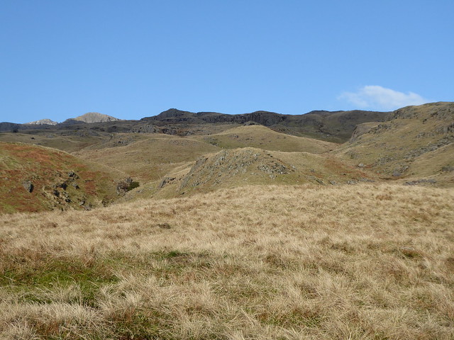
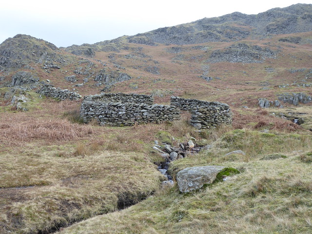
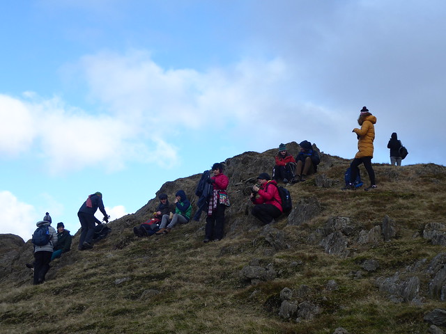
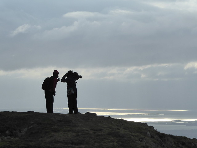
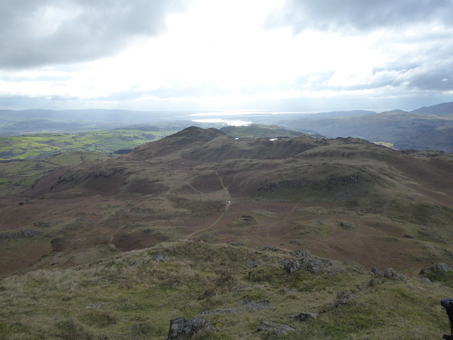
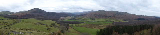
Before getting back in the car we took moment or two to look around us and enjoy being able to see further than a few metres ahead. We were intrigued by the small area of fell that had been walled off. Both Ed and I were aware that there is a Quaker burial ground in the valley, but neither of us knew its precise location or enough about it to be able to make an identification. Ed remembered that this particular area had previously had trees in it, and that didn’t quite seem to fit, so we went back to the OS map and, after a while, eventually identified it as a sheep fold.

Duddon Valley

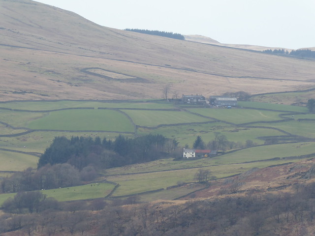
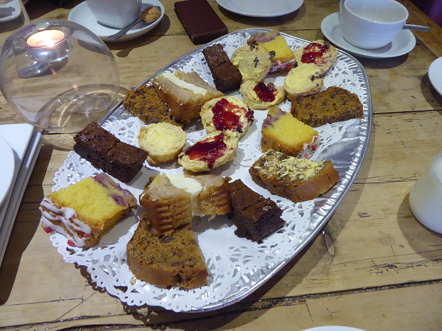
Ed had done some drystone walling for the National Trust nearby so, heading towards the Newfield Inn for lunch, we got into a conversation about how the stones from different valleys had their different characteristics and pros and cons for walling with. Round stones could get a bit tricks, whereas the flatter sheets were easier to stack but the thin layers meant it took ages to build them up to any height…

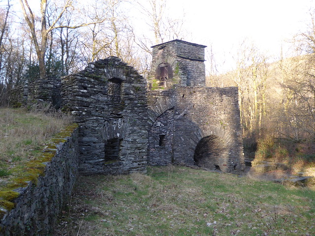
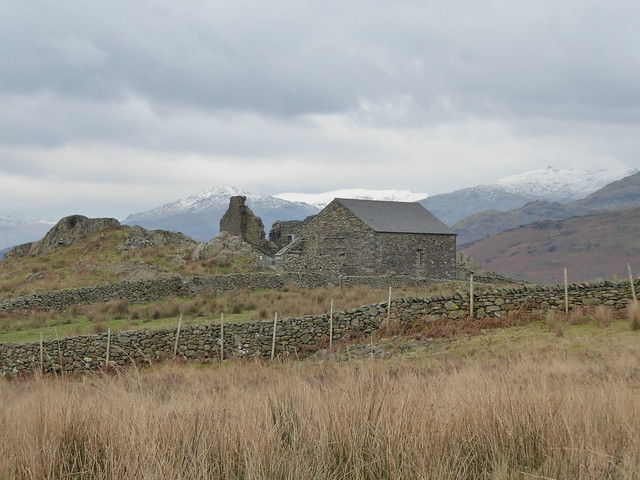
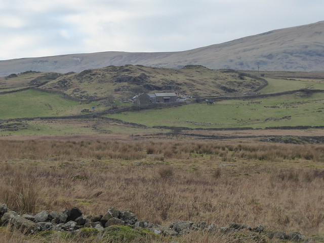
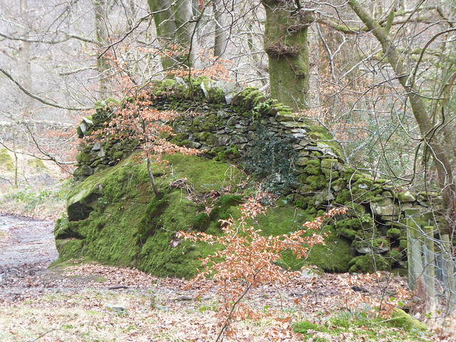
After lunch we worked our way down towards the estuary end of the valley. I had to stop the car to take a photo of the building below, having remembered from my research at the Wordsworth Museum a description of buildings that blended into their surroundings and William’s explanation that this was because the crevices in the slate afforded good spots for seeds to lodge and grow.


Duddon Valley

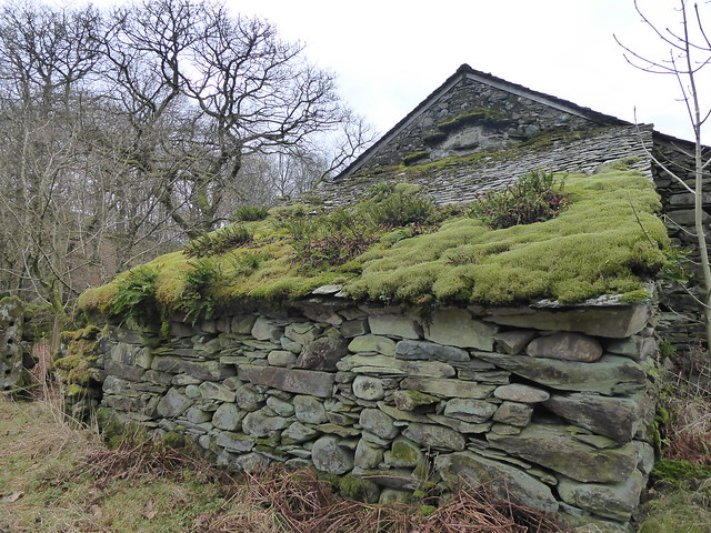
I’m liking the moss and the ferns on the roof tiles, but I also particularly appreciate the green shelves on the vertical of the main building behind!

A day in the reading room

This post was originally published over on the By Duddon’s Side project blog: http://byduddonsside.wordpress.com
~~~

To complement the reseach I’m doing in the Duddon Valley itself, I’ve also been working with the Wordsworth Trust’s archive to find a way in from that angle.

Naturally the weather was much better than when I was out on the fells the day before!

library view

Strategically positioned so I couldn’t see out of the window, I spent a day in the Jerwood Centre’s reading room where I was able to read Wordsworth’s sonnets relating to the River Duddon, as well as various people’s responses to them. Many thanks also to Anna the Assistant Curator for feeding me with items from the archive and with her own experiences and recollections.

research

In the February 1822 issue of the Lonsdale Magazine, there’s an article called Beauties of the North. Focusing on Duddon Grove (later to become known as Duddon Hall), it describes the improvement of the romantic glens and vales, and the rearing of lordly mansions in “places incomparably superior to any that have yet been selected”.

The Lake mountains abound with vales, each of which would amply furnish convenience for one gentleman’s seat. Their general character is this:—They open upon some large ale or lake—they are narrow and fenced on each side by rugged and lofty hills—they are enlivened by a rough tumbling brook—they are well wooded at the entrance—and they loose themselves behind among rugged mountain heads, abounding with game. A house would stand beautifully at the entrance of one of these glens, and fields would easily be redeemed from the smoother part of the woodlands, while the wood itself might be taught to climb the precipitous steeps on every side. The sweet retirement which places like these would furnish, and the beauty they would add to the country, is indescribable. Such places are Glencoyn—Glenridding—Grisdale—Deepdale—etc, at the head of Ullswater. Some of these have been improved; but there are numbers in all parts of the country waiting the mandate of taste, to start into paradisiacal existence.

I’m fascinated by the themes running through this article: of seeking out wild, open space in which to have freedom to move; of finding charming and picturesque locations in which to build your home; of ‘improving’ these locations through landscape design on a grand scale; and of the ideas of right and of possession and of good taste that underpin it all.

Flash forward to today when I see ‘NO PYLONS’ signs and also the Forestry Commission working to return areas of conifer plantation back to native mixed woodland. Anna also told me about projects such as this one to re-meander Swindale Beck.

It’s made me curious about how much of the landscape we revere as being wild and natural is actually a consequence of human interference?

In Stephen Gill’s writing on Wordsworth and Duddon, there’s a nice paragraph that feels like it might speak to this project:

Local specificity, local pride, loving attention to the unsung and little known are the keynotes not just of the sonnet sequence but of the whole volume.

I’m not encountering many people as I explore the valley (practically no-one, in fact), so I think it’s going to be challenging to get at what the Duddon means to people in terms of specificity and pride. On the other hand, those here in February possibly have a stronger connection to the place compared to the flow of day visitors I imagine the valley might experience in the summer months?

20170208_142708

I’d arranged to meet up and walk with Ed who had spent a few years living at the foot of the valley, so I also made use of the large library tables to plan an itinerary from a list of suggestions that he had sent me.


Copyright and permissions:

General blog contents released under a Creative Commons by-nc-sa license. Artworks and other projects copyright Nicola Pugh 2003-2024, all rights reserved.
If in doubt, ask.
The theme used on this WordPress-powered site started off life as Modern Clix, by Rodrigo Galindez.

RSS Feed.