CeMoRe walking seminar

This post was originally published over on the By Duddon’s Side project blog: http://byduddonsside.wordpress.com
~~~

My residency exploring the Duddon is part funded by the Centre for Mobilities Research at Lancaster University, and as part of my visiting fellowship with them I instigated a walk around an area of the Dunnerdale Fells.

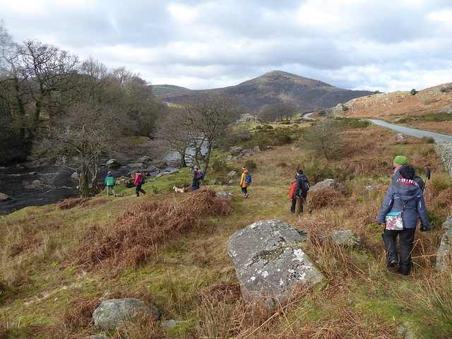
Below are a selection of photos from the walk, more are over in this album on Flickr.

It wasn’t a guided tour as such, more an opportunity for people from various backgrounds to gather and to use the act of walking to observe and comment differently on the landscape.

A great mix of people came along, including artists, mobilities researchers, students and someone from the management school. (This is one of the things I like about Mobilities Studies – that it can bring in people from lots of different disciplines.)

CeMoRe walking seminar around Dunnerdale Fells

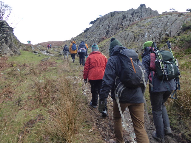
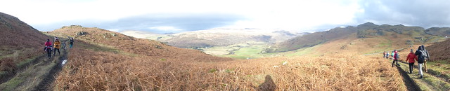
Our initial introductions were hampered slightly by the fairly substantial climb right at the beginning, but we gradually got to know each other over the course of the following 4 miles or so.

CeMoRe walking seminar around Dunnerdale Fells

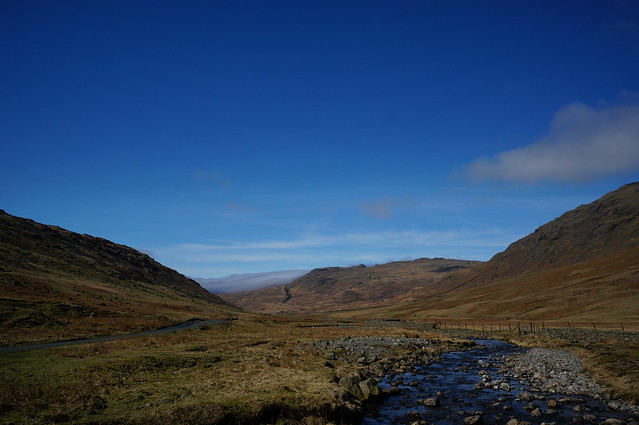
The weather was cycling through a selection of different settings, althoug thankfully rain and fog weren’t on the menu and our hard work was rewarded with some stunning views and dramatic changes in light.


CeMoRe walking seminar around Dunnerdale Fells

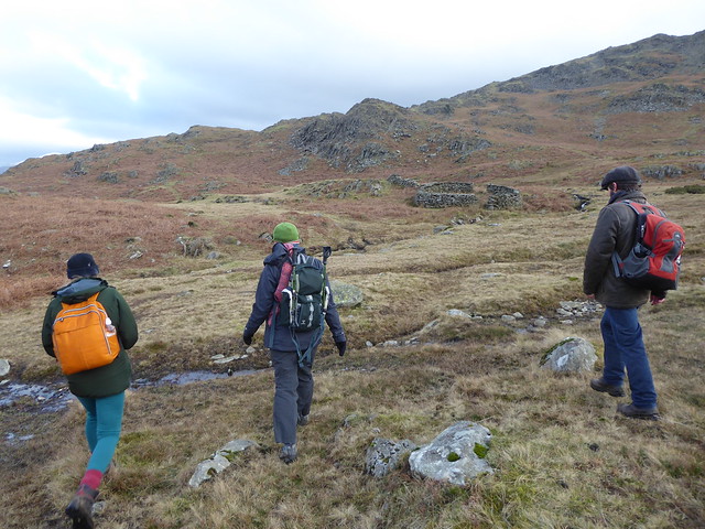
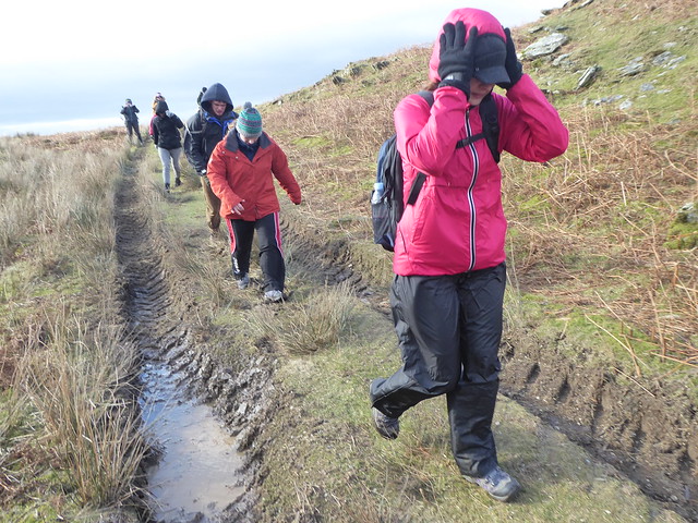
The immediate terrain also gave us plenty to think about as we negotiated a selection of bridleways and footpaths, sometimes requiring us to cross becks and other boggy bits.

CeMoRe walking seminar around Dunnerdale Fells

CeMoRe walking seminar around Dunnerdale Fells

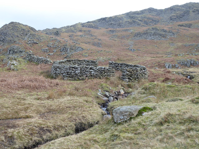
The stone sheep fold (and nearby contemporary galvanised metal sheep feeder) were a bit of a jarring human presence up on the fells, just as we were starting to relax into the isolation.


CeMoRe walking seminar around Dunnerdale Fells

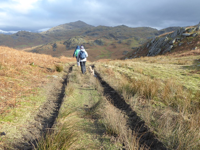
We followed deep tyre tracks for a short while, but our attention here was more focused on the incredibly strong winds as we went over a particularly exposed ridge.

CeMoRe walking seminar around Dunnerdale Fells CeMoRe walking seminar around Dunnerdale Fells

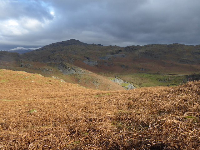
Oh, but the views though!

CeMoRe walking seminar around Dunnerdale Fells

CeMoRe walking seminar around Dunnerdale Fells

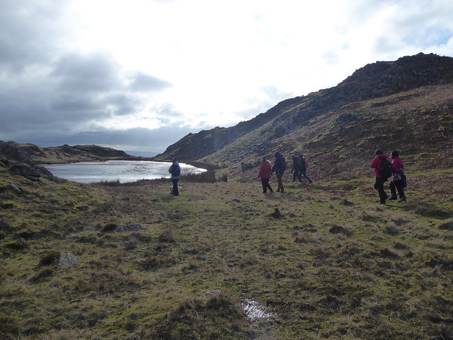
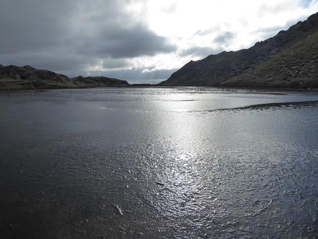
Stickle Tarn elicited a few exclamations along the lines of “Wow! Brilliant!” as we rounded a corner.

CeMoRe walking seminar around Dunnerdale Fells CeMoRe walking seminar around Dunnerdale Fells

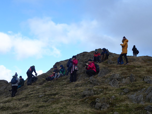
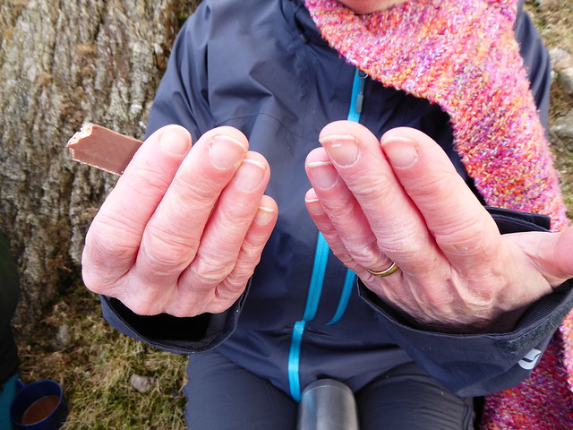
We decided up here was probably going to be the most sheltered spot we were going to find and so we settled down (briefly) for our lunch. We didn’t linger for long though, as it was bitingly cold and we were starting to feel the need to be moving again.

CeMoRe walking seminar around Dunnerdale Fells CeMoRe walking seminar around Dunnerdale Fells

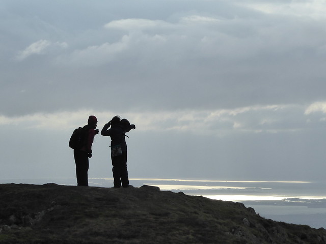
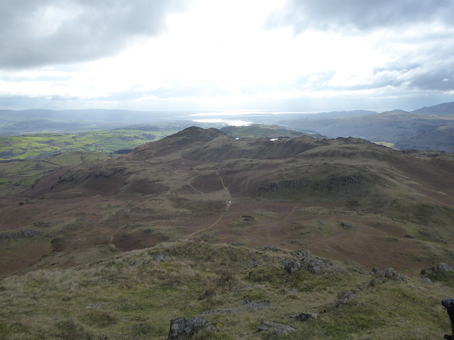
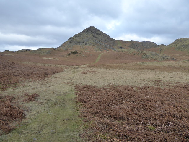
Our opportunity to warm up came with the very steep scramble up to the top of Stickle Pike  (seen from the other side in the photo below). The payback came in the form of views right out to Duddon Sands and the estuary.

CeMoRe walking seminar around Dunnerdale Fells

CeMoRe walking seminar around Dunnerdale Fells

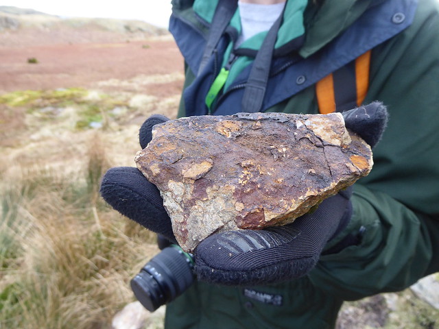
Circling back around in the direction of Great Stickle, Tess (previously a Geology student, but now working towards a PhD in Art) taught us about how quartz tends to be found alongside other ores.

CeMoRe walking seminar around Dunnerdale Fells CeMoRe walking seminar around Dunnerdale Fells

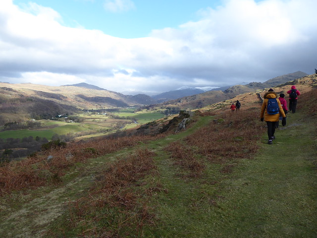
By the time we started to drop back down towards the floor of the valley, I’d also had conversations with people about guidebooks, how things get edited out of the record, Lord of the Rings, avatars and temperature, alternative formats for submitting work for assessment, and being the world expert on your practice.

Sadly I missed out on the conversation about the tapir.

CeMoRe walking seminar around Dunnerdale Fells CeMoRe walking seminar around Dunnerdale Fells

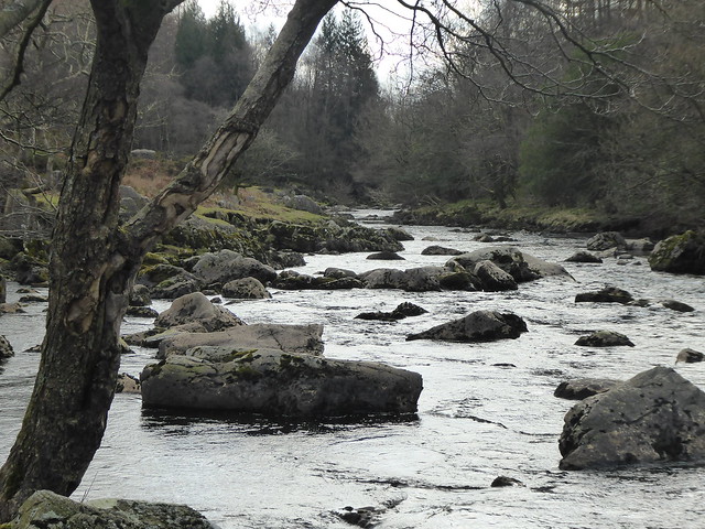
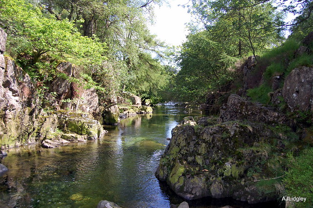
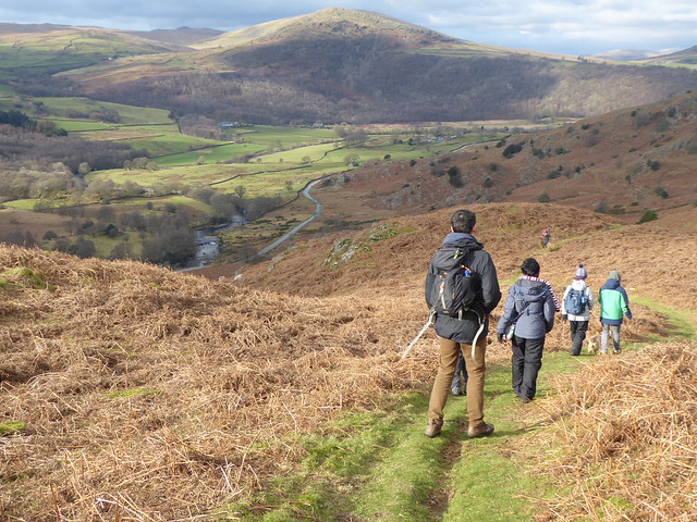
The last section of our walk followed the course of the Duddon back upstream, and there were appreciative noises all round at the change in surroundings. Pretty much we could all understand why the Duddon has a special influence on people.

CeMoRe walking seminar around Dunnerdale Fells

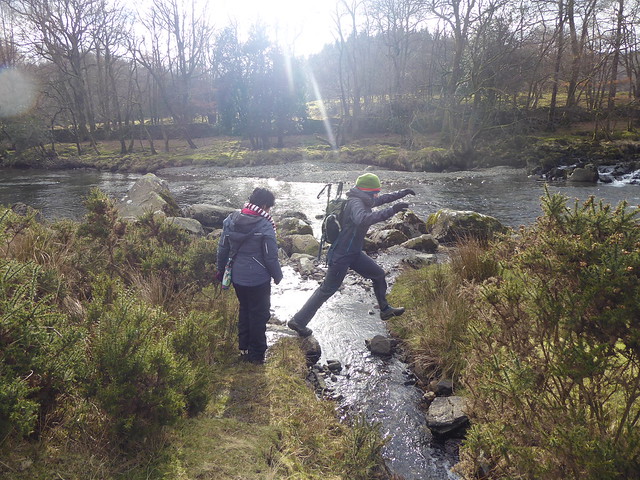
By this time I was nurturing a bit of a fascination for that moment when people leap across small streams, and managed to snap a few photos of jumpers in action.

CeMoRe walking seminar around Dunnerdale Fells

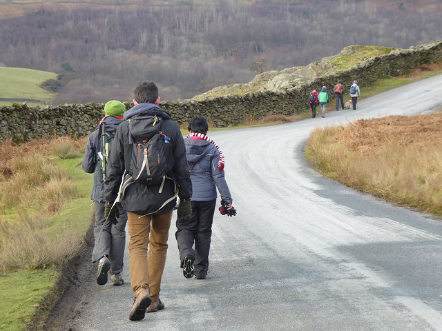
Shortly afterwards we had all made it back – dry – to the cars and then we relocated to the pub for a debrief chat about the things that we had noticed about the area and also about the effects of walking and talking at the same time as opposed to trying to cover the same ground whilst sat in a room somewhere.


Announcing ‘Deep Mapping the Duddon’

UPDATE: This project is now called “By Duddon’s Side” and is being documented over at https://byduddonsside.wordpress.com

The River Duddon

Photo by casper_chole on Flickr, CC by-nc-nd, click for original

Back in September I was awarded a Visiting Fellowship by the Centre for Mobilities Research at Lancaster University to help support a collaboration with Dr Christopher Donaldson (Lecturer in Regional History and Co-Investigator on the Leverhulme Trust-funded Geospatial Innovation in the Digital Humanities: A Deep Mapping of the English Lake District project, also at Lancaster University). Since then Chris and I have been working hard to link things and amplify things and – following on from receipt of additional funding from Arts Council England – I’m very happy to now be able to announce that for the next few months I’ll be working with Chris, primarily based in the Lake District.

We’ll ‘deep map‘ history and memory in the Duddon Valley, where the Geospatial Innovation research group’s work will also support the Wordsworth Trust to explore different ways of increasing public engagement with the works of William and Dorothy Wordsworth.

In addition to featuring in the work of the Wordsworths, the Duddon Valley was home to prehistoric and Roman remains, medieval longhouses, and ancient farming communities. It has a strong industrial past (mills, quarrying and an iron furnace) and nowadays attracts tourists ranging from fell walkers and mountain bikes through to those taking a more leisurely approach to exploring the area.

I like a good palimpsest of landscape and stories!

Our activities will map how different layers and traces overlap and interact to contribute to community identity and sense of place. Chris is already working with local groups to research a collection of Victorian and Edwardian photographs of the valley. I’ll be helping with this and also developing my own site-specific tools and processes for engaging with the stories of the Duddon Valley. Later we’ll be bringing these together in an exhibition at the Wordsworth Museum (Grasmere) and I’ll be working with Chris and the Trust in designing something that we hope will prove to be multisensory and interactive.

Sign up to my newsletter for updates as the project develops, or follow along in real time on Twitter.


Duddon Valley

Photo by andrew_annemarie on Flickr, CC by-sa, click for original

~~~

Supported using public funding by the National Lottery through Arts Council England.

Additional support from Lancaster University (Geospatial Innovation in the Digital Humanities, Department of History, Centre for Mobilities Research, Lancaster Institute for Contemporary Arts) and the Wordsworth Trust.


Copyright and permissions:

General blog contents released under a Creative Commons by-nc-sa license. Artworks and other projects copyright Nicola Pugh 2003-2024, all rights reserved.
If in doubt, ask.
The theme used on this WordPress-powered site started off life as Modern Clix, by Rodrigo Galindez.

RSS Feed.