Cross purposes

This post was originally published over on the By Duddon’s Side project blog: http://byduddonsside.wordpress.com
~~~

Returning from my failed ascent of Harter Fell, I stopped at the old packhorse Birks Bridge (not the more modern one by the car park).

As I snapped away, happily taking photos of the bridge and of the gulley it spanned, I became uncomfortably aware that these images all seemed familiar and that I was just taking the same photos of everybody else; that these were the same images I had already encountered online doing my preliminary reading about the Duddon Valley.

Duddon Day 01 Between Gold Rill Dub and Birks Bridge car park

Between Gold Rill Dub and Birks Bridge car park 
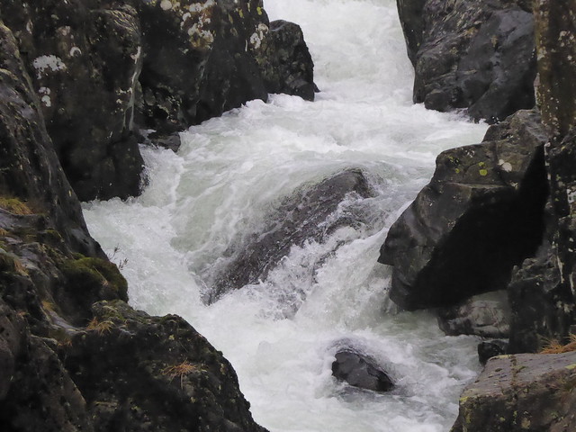
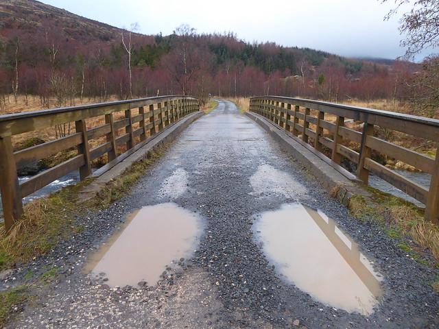
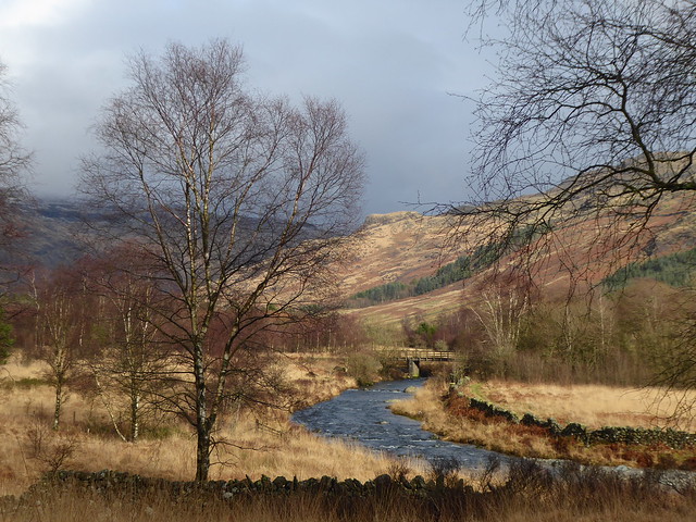
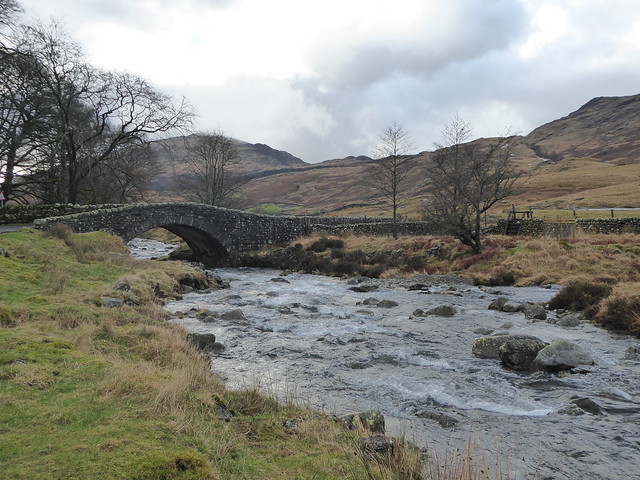
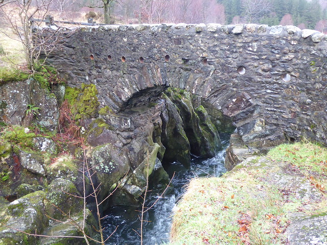
I had very mixed feeling about this. Yes, it’s very picturesque, but as an artist I feel I should work a bit harder to look a little beyond the obvious. Then it struck me. All our photos seem to focus in on the river, but what about if we pay attention to what’s happening perpendicular to this? What happens if we instead think of the thoroughfares that the bridges were built to transport over the water? Suddenly the bridge looked very different! Between Gold Rill Dub and Birks Bridge car park

Between Gold Rill Dub and Birks Bridge car park 
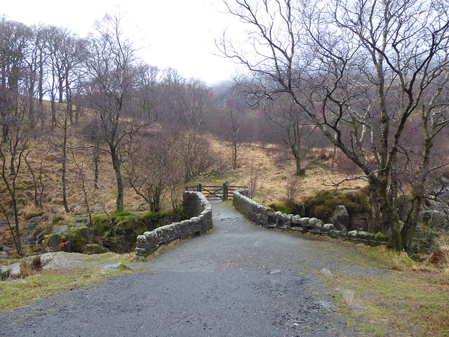
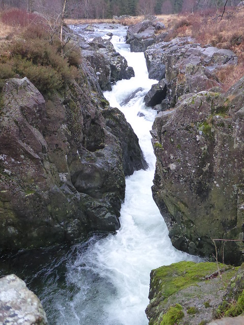
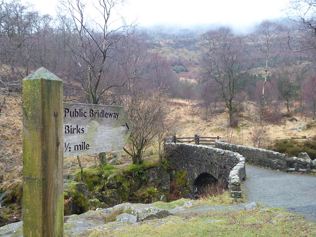
I was still mulling over this shift in viewpoint when I arrived back at the more modern Birks Bridge. Birks bridge car park bridge (not Birks bridge). I think...

I don’t yet know where this train of thought will take me, but I think I need to resolve to look beyond the postcard views and look at things sideways on.

Not quite Harter Fell

This post was originally published over on the By Duddon’s Side project blog: http://byduddonsside.wordpress.com
~~~

Having successfully driven over Wrynose Pass, my plan was to then get out of the car and do a bit of walking. Online, I’d found a short circular walk that included climbing to the top of Harter Fell, where I’d also read the views could be great. Whilst I wasn’t sure I’d have a clear view, I thought I’d give it a try and, if I could , then that would be a great way of getting a sense of the valley.

Between Duddon and Dunnerdale Forest

Starting from the carpark near Birks Bridge, I negotiated some boggy ground before entering what the walk’s author had described as ‘desolate forest’. It was an uncannily good description. The photo below doesn’t really convey the feeling of it, but perhaps you get an inkling.

desolate forest

Hardknott forest is currently being restored from a conifer plantation to “native habitats of oak and birch woodland, bogs and open ground”. Well, I’d already found the bog, maybe the desolation was also by design?

Riding up out of the forest at Birks, I relocated the bridleway and, it turns out, lots more bogginess. There was a lot of water running off the fell, and in some places the track I was following was indistinguishable from a stream bed.

As I got higher, the way became harder to spot and, with the arrival of some rain showers, also quite slippery.


Mart Crag

I weighed my options and decided that it was probably best for me to cut my losses, turn around and head back down into the valley.

A couple of quick photos whilst perched on a rock, and then the rain started in earnest and I had to find a relatively flat spot on which to wrestle on my waterproof trousers!


Mart Crag

Mart Crag

This is as far as I made it before turning back (the blue line shows my track and the yellow line was the rough route I was hoping to follow):

Harter Fell (ish)

I think that means I made it onto Mart Crags, but not really anywhere near the top of Harter Fell. Oh well.

Having done a bit more reading online since, I think if I tried it again I would use the more southerly route that I had intended to use for my descent. There’s a nice write up of this alternative route here, with some lovely photos taken on a gorgeously clear day.

After returning to Birks I veered off to the right rather than retracing my steps back to the car. I wasn’t sure what to expect by this stage, but hopefully it would be a bit drier!

After a going over some fields and a little bit – but not too much – squelch, the bridleway nipped over a stone wall and suddenly I was following a nice wooded track.

Between Birks and Gold Rill Dub

Between Birks and Gold Rill Dub

I really liked this stile without an obstacle that looked a bit like some odd seating arrangements or some sort of minimalist sculpture.

Descending further down into the valley I increasingly became aware of the sound of pounding water. Ah! I must be getting close to the Duddon again!

The path took me close to the edge of a steep drop which I was reluctant to approach any closer, so I listened to the river for a while longer without being able to see it. Rounding a corner there was this dinky little bridge and Duddon itself. Now I could understand what all the noise was about!

Between Birks and Gold Rill Dub

Gold Rill Dub Gold Rill Dub

Crossing at the wooden (and very slippery) footbridge, I regained the tarmac’d road and made my way back to the car park, stopping off every so often to take a few photos.

Between Gold Rill Dub and Birks Bridge car park

Here’s one looking back up at the summit of Harter Fell. (Or where the summit should have been.) Probably just as well I didn’t push on for the top, as I don’t think I’d have seen much….

Between Gold Rill Dub and Birks Bridge car park


Over the top

This post was originally published over on the By Duddon’s Side project blog: http://byduddonsside.wordpress.com
~~~

Having chickened out of it on my quick recce to the Duddon Valley a fortnight ago, the time had come to bite the bullet and see if my car was up to the challenge of driving over Wrynose Pass. Success here would influence logistical decisions later on in the project, so I had to find out if it was an option or not.

morning walk into town

The view from Dove Cottage in the morning was of snow-dusted peaks and lingering cloud, so I wasn’t sure what I would be met with once I started to climb the pass.

Wrynose Pass

Well, a closer view of the snow, for a start!


Wrynose Pass

Wrynose Pass

Also some glorious views and dramatically-lit landscapes.


Wrynose Pass

I justified several photo stops in terms of giving the car a chance to cool down a bit!

I reached the top with no automobile-related dramas and crested the top of the pass to be greeted with…

Wrynose Pass

Ugh! A valley full of raincloud! Typical!


Wrynose Pass

It brightened up for a few more photographs and an opportunity to pause and reflect on how rapidly the Duddon had grown from the tiny little becks I’d seen earlier, to something that could now reasonably be called a river.


Cockley Beck bridge


I found myself wondering how one would have traveled between Grasmere and the Duddon Valley at the end of the 17th Century. Would it have been something you could have done as a day trip, or would it have been an undertaking of a few days?


First encounter with the Duddon

This post was originally published over on the By Duddon’s Side project blog: http://byduddonsside.wordpress.com
~~~

I travelled up to the Lake District for a preliminary meeting at the Wordsworth Museum. Having a bit of time to spare I thought I’d take a detour to check out the valley that will be the main focus of this project.

Visibility was somewhat reduced and it was quite squelchy underfoot, but after 10 minutes strolling around on the banks of the Duddon near Ulpha I could understand that this place is a little bit special – I’m very much looking forward to having a proper explore.

32373633042_4b1a704b31_z

32403970101_8bcb0fe169_z

31713757443_b0639b8893_z

32373262562_83324bff4f_z

Free Longbridge Art Service

Yesterday I joined forces with Hannah Hull to provide a special, for-one-day-only, free public art service for Longbridge as part of our commission for EC Arts.

We struck out down the Bristol Road and found a parade of shops that seem to have been passed by by all the regeneration efforts several hundred metres away and decided it would be nice to give them some attention.

We went into several of the shops introducing our art service and offering to provide creative services, be it drawing, painting, sculpture, performance or socially-engaged interventions.

After more or less discussion, some of the shopkeepers came to the conclusion that they were not in need of our services. We asked them to fill in an entry in our receipt book to certify that “no art is required today”.

For some, this was because they saw no need for any additional art in their life, or because they did not feel qualified to be able to make the decision themselves, instead asking us to return when other family members would be present.

For others, this was because they were more than capable of being self-sufficient in their art requirements. As soon as we introduced ourselves to the staff in the tattoo studio, one man immediately dashed out to a back room and returned with these paintings that he had done:

Next to him was sat a young woman sketching out a Jack-Nicholson-as-the-Joker portrait for what we think was going to be a calavera sugar skull.

We were quite envious of her pro pencil kit and putty rubber.

Of the 8 shops we visited, we ended up being commissioned for art services from 3 of them, and we had such an interesting conversation with a woman in a 4th that we were moved to make an uncommissioned artwork for her:

Next time you’re in a shop in Longbridge, have a think about the person serving you and wonder if they’re really a secret artist.

Of the official commissions we received, there was a strong signage theme. The man in the electronic cigarette shop is unhappy with his boring black front door and wants to paint it up so it’s more catchy.

We measured the door and then sketched out a few different approaches he might consider. Unfortunately we didn’t have much in the way of paint with us, but what we were able to do was set up a potential link with a student at Bournville College who’s interested in doing some graffiti-style work. We all thought this could be a nice pairing!

The man in the tool hire shop requested some designs for a mural on his outer side wall in a style not entirely dissimilar to the signs that could be seen around the shop counter. With added tool-based word play.

We suggested that this might be a bit sexist and sketched up a few variants on the theme that were more encompassing of other types of relationships and gender identity.

Perhaps our most successful commission was completed for Mandy in the convenience store. After a bit of a chat we discovered that she was quite frustrated at always having to direct customers towards the bread. Finding the milk often seems to be problematic too, but we really liked the signs she’d made for the fridges and so we decided to concentrate our efforts on bread wayfinding.

After checking how the sign could be hung from the ceiling, Hannah used her stencilling skills to put together a rather eye-catching three-tier bread sign.

We’re rather pleased with the results – here’s the sign being installed:

Hannah also took this rather nice portrait shot of our happy customer:

Bread, sign, portrait. Photo: Hannah Hull

All commissions were documented via report sheets detailing client details (name, age, ethnicity); description of art services provided; duration of art service; venue of art service and whether the art service made people happy.

We had a 100% success rate with that last one.

Art service recipients will also be entered into a free prize draw – more on that later…


These events are part of Longbridge Public Art Public (LPAP) conceived by EC Arts for and on behalf of Bournville College. For more information visit www.lpap.co.uk.

A Road Trip for Longbridge – dates announced

Austin Park, with Bournville College in the background.

I’ve been working with cultural planner Jenny Peevers to find a way to harness the Road Trip I’ve been developing as part of my Longbridge Public Art Project commission so that the conversations catalysed though it can be more effectively turned into actions.

As a result, we’ve linked two of the Road Trip events to two Supper Club meals that Jenny’s organised as part of a larger series.

Here’s how she describes the Supper Clubs:

…an exchange of food, stories and future possibilities. We bring the food, you bring the stories.

Through your stories we will map collective hopes and aspirations, getting more local voices heard as the new Longbridge grows.

So, on the 5th and 26th of April, you can spend the afternoon with me touring different corners of Longbridge and the surrounding areas looking for new angles on the theme of community, and then segue smoothly into a meal and some activities designed to identify what changes people would like to see taking place in Longbridge over the next few years.

Both events are free, but you will need to sign up in advance via these eventbrite pages (NB ticketing closes the Monday before each event so Jenny has time to prepare all the food!):

Road Trip + Supper Club combination, 5th of April, starting from Reaside Community Centre.

Road Trip + Supper Club combination, 26th of April, starting from Longbridge Methodist Church Hall.

For those of you who would like to take part in the Road Trip but not the Supper Club events, there is a Road Trip only taking place on the 29th of March. Sign up for your place on the minibus here.

Our conversation (although not necessarily the journey itself – check the sign-up pages for starting locations!) will start at Austin Park where the River Rea has been ‘realigned’ to look more natural. Our effect on our surroundings and our surroundings’ effect on us will be a recurring theme throughout the day.

Join us and add your feet and your voice.


These events are part of Longbridge Public Art Public (LPAP) conceived by EC Arts for and on behalf of Bournville College. For more information visit www.lpap.co.uk.

Tell me something about… Frankley Services and St Leonard’s Church

As part of my research for the A road trip for Longbridge guided tour, I’m keen to hear your stories, anecdotes and interesting facts about places on the route.

First up are two locations over Frankley way…

Frankley Services

Photo credit: Robert Soar

Apparently one of the oldest service stations of its kind (opened in 1966) Frankley Services must have seen some interesting things. Have you? Can you tell me about something that happened here?

St Leonard’s Church

St Leonard’s Church at Frankley – click through for location on Google maps…

A rural church a stone’s throw from Frankley Reservoir. I hear it’s really popular for weddings. Can you tell me anything about it, or perhaps describe why you chose to tie the knot there rather than anywhere else?


If you’ve got something to share, please add it to the comments for this blog post.

A road trip for Longbridge

As I mentioned recently, I’m one of a cohort of artists and other practitioners involved with the Longbridge Public Art Project (now with its own website).

Following those first explorations on foot, Colin Corke (vicar at St John the Baptist, former chaplain at the Longbridge car plant and general Austin/Rover aficionado) was kind enough to give me a motorised tour of the area.

We talked about communities, places to gather, places to get away to, landmarks, things that aren’t there and, yes, maybe a bit about cars too!

I found this a really eye-opening way to think about Longbridge and, as a result, I’ve decided that my main project for the residency will be to develop a guided tour taking in a selection of locations that relate to the themes of community, roots, travel and flows. A road trip for Longbridge.

I’m working with local residents and staff and students of Bournville College to pull together the content for the tour. See this post for my first request for stories about Frankley Services and/or St Leonard’s Church.

The draft route is currently weighing in at about 25 miles, so I think I’ll be researching mini-bus hire in the near future too!

Welcome to Stirchley (Take me; I’m yours)

Limited edition laser-cut plaques for those who know where to find them.

Welcome to Stirchley

Welcome to Stirchley

Traces of doings with Ikon and BIAD

The Northfield work I was involved with for Ikon Gallery is being showcased over the next few days. Their publicity seems to feature a photo of me pulling a jib rather extensively, but I hope that’s not reflected in the content of the exhibition.

11am–6pm until the 3rd of February
Events Room, Ikon Gallery

Hopefully some of the Mum Signs may leach out into the surrounding area, too…

~~~

I’ve also done a few more days with the second year students at BIAD, helping them refine their ideas and builds for the Mis-fitting project.

There will be scaly coats, stilt-walking sculptures, spongy red men, shopping bag costumes, generous plant pots and more, all making their appearances around Birmingham city centre over the next week or two. If you spot one of the happenings, feel free to join in and get involved!


Copyright and permissions:

General blog contents released under a Creative Commons by-nc-sa license. Artworks and other projects copyright Nicola Pugh 2003-2024, all rights reserved.
If in doubt, ask.
The theme used on this WordPress-powered site started off life as Modern Clix, by Rodrigo Galindez.

RSS Feed.