Platinum at The Edge

Myself and the other artists from the current Platinum cohort will be presenting our various works in progress at a public event to be held at The Edge on the evening of Thursday 2nd of June.

The artists involved come from a diverse range of backgrounds, and the work on show will range from performance through to endurance; presentation through to exploration.

Rob Jones: My Piece

An exploration into personal fears. This work will involve sharing a series of experiences.

Nikki Pugh: Prototypes for Colony

A playful device that aims to gently nudge and augment people’s perceptions of the urban landscape.

Aleks Wojtulewicz: fr36ze

An exploration of the stimulatory effects of adrenaline. The physical act is militaristic.

Sarah Farmer: Cultural Amnesia: what we lost in the fire

A research-led investigation of the cultural history of the arts in Birmingham from the perspective of recent graduates.

Lucy Nicholls: In Preparation for Death

Researching the commodification of the ritual of funeral, while exploring death within its wider social and cultural meaning.

Mark Essen: Club Hot Zeus; BAD MUSIC

John Napier and CLUB HOT ZEUS present BAD MUSIC.

The first prototypes being tested around Digbeth. This time they'll vibrate in response to their surroundings!

I aim to have two prototype organisms there as part of the development of my work in progress Colony. I’ll give a short introductory presentation and there will be a limited number of slots available for you to take the prototypes out for an exploratory walk around the streets of Cheapside.

Do come along if you’re in the area. Free entry; cash bar; FaceBook event.

Making the Colony prototypes landscape aware

Another compilation of Tweets.

These last few weeks I’ve been giving the development of Colony an extra big push to get it as far along as possible ready for next week’s public event.

Having previously been able to get the tech working on a temporary breadboard set-up, the next stage was to solder everything onto a more robust base that can be used inside the organisms that get carried around. The next stage after that was to start carrying it around!

With the circuitry in a shoulder bag, one GPS receiver on my left shoulder and the other in a glove on my right hand with a vibrating motor, I made myself more location aware as I made the 3.75 mile walk to and from work yesterday and the day before.

The code generates a measure of difference between the two calculated positions and then buzzes out a code so I can feel the values as I walk.

Initial findings are: it’s great! Super-exciting to have that extra sense that no-one else is aware of, and you can see the trends in output as you move from one type of terrain to another.

I’ll be refining the code over the next few days and also getting the circuitry into an organism ready for carrying. Do come along to The Edge on Thursday to find out how I’ve got on.

WE ARE THE SPLACISTS!

A year ago Paul Conneally contacted me voicing his dislike of our recent work being labelled as “psychogeography” and “situationist”; for these are terms that are left-overs from the 70s.

He invited me to join him in Splacism: “a new movement a new set of ideologies […] with manifestos and the like – all still to be written including the definitions describing the movement”.

~~~

Last Tuesday I gathered people from different disciplines around me to give feedback on a newly-started project. After bemoaning the perceived lack of a peer group to one group of guests, the response was that I should celebrate my unique position between disciplines and become my own movement.

Later conversation rather suggested that one Hannah Nicklin identified with that too.

~~~

It wasn’t until later that evening that I remembered I already had my own movement – technosplacism as a subset of splacism.

24 hours later Hannah and I were brainstorming a manifesto.

~~~

WE ARE THE SPLACISTS

We will own this city.
We will take it back.
We will link and shift.
We will affect and be affected.
We will look, and be seen.
We will expose and re-see.
We will glory in the moment, the collage, the marking and then passing on.
We reject the beginning, middle and end.
We reject your shopping centre, your pavement, your cultural quarter.
We will build our own constructs.
We will build our own bridges.
We will find the edges and push them.
We will fail spectacularly, vitally, elegantly.
We will span.
We will look up, down, under and behind.
We will leap.
We will invite others to do these things too.
We will make exchanges.
We will make adventures.
We will make beautiful moments.
We will reveal the ugly.
We will hold your hand.
We will whisper in your ear ‘let go’.
We will run, skip and jump.
We will be motionless.
We might dance.
We will dream.
We will be generous, but we may subtle about it, too.
We will reclaim the city, not for you, but with you.
We are you.

WE ARE ALSO THE TECHNOLSPLACISTS

We will learn how to use the tools that make the things we want to happen happen.
We will help others learn wherever we can.
We will construct our manifesto – collaboratively – online, because the Internet is also a space :)
We will shift between space, online and off, taking on the form and the arena that suits us best.
We will bodily augment the layers of virtual space, story, marketing, capitalism, that exist in the city, with our own stories.
We will hold the data-harvesting done in the city in the name of ‘games’ (foursquare, loyalty cards) accountable.
We will find our own energy sources.
We will learn how to flex the central nervous system of the city – the data streams in its weather detectors, CCTV, red light cameras – for our own aims.
We will release all that we can via creative commons, so that they can be reclaimed, remixed, re-purposed.
We will cut, and we will paste.
“Plagiarism is necessary, progress demands it.”
We will pervade.
We will not be technosplacist when being splacist will suffice.
We will never underestimate the power of gaffa/electrical/masking tape
We will be artful. We will be skillful. We will fail usefully.

~~~

I don’t know if this is the Splacism Paul had in mind all that time ago – I’m not even 100% sure if this is the Splacism I have in mind now – but it’s a mighty fine start and writing the manifesto was a very interesting process.

We’ll let them sit for a while and see what they evolve into. As Paul said: “let [the words] become themselves and more…”
Uncertain Eastside – Document One: 2009

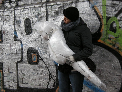
It’s a very great pleasure to be able to announce the release of my first publication.

Having a quick flick through the 112 pages.

As shown by the rather long list on the title page, other people have put loads of effort into this as well. Thank you to everyone who has supported this project.

Uncertain Eastside – Document One: 2009 brings together activity from my first year of investigating my relationship to BCC‘s ‘Eastside’ regeneration zone and logging the micro and macro changes in the landscape as time passes. It’s Eastside in three parts: past, present and future.

Bursting with goodness over three acts!

The book starts with a manufactured history contributed by the indescribable Ben Waddington: a day as seen from the perspective of a family living in Digbeth. Pay attention – this text is as much about the present day and October the 18th, 2009, as it is about November the 1st, 1860.

Next, now firmly in 2009, the book gives an overview of my alternative cartography of the regeneration zone’s perimeter and a selection of 83 lush colour photos selected from the 1000+ submitted by participants of the Walk and Talk event.

The book finishes off with a text from much-respected architect and urban designer Joe Holyoak and Tracey Fletcher from the Eastside Sustainability Advisory Group. Written 8 years ago it describes a day in the life of a family inhabiting an Eastside of the future. 2012 now seems both just around the corner and impossibly distant.

You can buy copies of Uncertain Eastside from http://www.magcloud.com/browse/Issue/131607 where there is also a link that allows you to preview the book’s contents.

Magcloud are running a special offer until the end of the year that means you only pay $22.15 (≈£14) rather than $28.00 (≈£17.50). Your order is then printed up and delivered to you within about a week, so there’s time to get some as Christmas presents!

Again, a special thank you to everyone who has taken part in the making of this publication: Pete Ashton, Karen Cameron, Mike Cummins, Ida Deodathsingh, Emma (editorialgirl), Tracey Fletcher, Joanna Geary, Nicky Getgood, Michael Grimes, Marian Hall, Libby Heighway, Mark Hill (cybrum), Joe Holyoak, Alex Hughes, Nancy Langfeldt, Ben Mabbett, Steve Scott, Tim Stock, Chris Tomlinson, Ben Waddington and Simon Whitehouse.

Plans are afoot for Document Two. Watch this space…

19,264 seconds of qualitative and quantitative data (Curzon Street, 2010)

What started as an exploration into my relationship as an artist to a proposed cultural quarter has expanded to also include a significant amount of sustained investigation into witnessing and documenting the change in that urban landscape.

Last year my focus was on the perimeter of Birmingham City Council’s regeneration area. Since walking and gathering the GPS data for Uncertain Eastside and organising the Walk and Talk event (in which we gathered lots of visual and anecdotal data) I’ve been increasingly aware of buildings going up and coming down in the area around Curzon Street and Millennium Point.

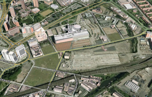
The Google Earth view of the area (with imagery that seems to be from 2007) is already drastically out of date, but it gives a rough idea about the range of contrasting terrain there now.

As well as spending hours walking all the streets in the zone I’ve selected, concentrating on paying attention to the details of the spaces, I’ve been collecting and processing GPS data to use as a measure of how developed the streets are. I will repeat this over the years to come as a way of logging the changes taking place on both macro and micro scales.

Google Earth view of the area I've been investigating

Google Earth view of the area I've been investigating

At the bottom left of the image above there is a relatively green area: old factory plots that have now turned to grassy wastelands and the park on the corner at the top of Fazeley Street.

Bartholomew Street, now closed to traffic and without any buildings around it. The bottom right corner shows where my path passes under the railway arches at the corner of Fazeley and New Canal Streets

Bartholomew Street, now closed to traffic and without any buildings around it. The bottom right corner shows where my path passes under the railway arches at the corner of Fazeley and New Canal Streets

Here the GPS data is fairly consistent. Water-heavy buddleia bushes overhanging the pavements on closed roads induce a few wobbles and railway viaducts cause momentary loss of signal, but on the whole the open terrain doesn’t interfere much with calculations of position.

Contrast this with the data gathered from around the various Further and Higher Education buildings on and around Fox Street and Grosvenor Street.

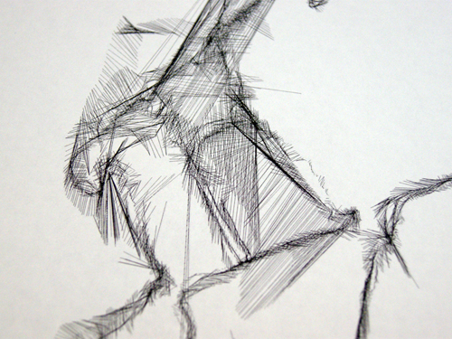
Tall buildings closely packed together reflect and block the satellite signal, causing the GPS calculations for position to be very inaccurate.

Tall buildings closely packed together reflect and block the satellite signal, causing the GPS calculations for position to be very inaccurate.

At one point one of the GPS devices calculated I simultaneously had one hand next to the halls of residence and the other on Digbeth high street opposite the coach station! (About 800 metres away.)

If even a small proportion of any of the various plans for Eastside are realised we look set to get more lines like this in the future.

I’ve come to refer to those two areas respectively as the Green Zone and the Learning Zone. The third zone in the area is the Rubble Zone – the plots between Millennium Point and the ring road that have been razed with the exception of 3 buildings: Belmont Row Co-op works, the lock keeper’s cottage and the Moby Dick’s pub.

From left to right: Cardigan Street, Gopsal Street, Penn Street and a tiny piece of Belmont Row. Currently mostly rubble.

From left to right: Cardigan Street, Gopsal Street, Penn Street and a tiny piece of Belmont Row. Currently mostly rubble.

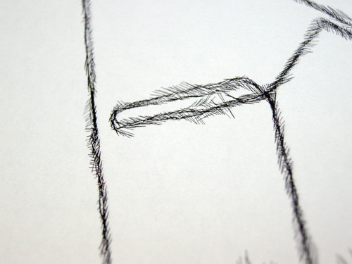
The presence of all three of these buildings can be seen to affect the GPS traces. The image above hints at Moby Dick’s on Gopsal Street. For now the lines are uniformly short, but stand by for Eastside Locks. [link to pdf of proposed developments]

So there we have it: a snapshot of a part of Birmingham before it changes beyond recognition. Quantitative data gathered over several hours of walking a set pattern of streets whilst paying attention to the details, the changes and the people – I’ll tell you about it on a walk or in a pub sometime. Qualitative data in the form of 19, 264 lines that speak volumes if you know how to listen – probably a limited edition print coming soon.

19,264 seconds of qualitative and quantitative data (Curzon Street, 2010)

19,264 seconds of qualitative and quantitative data (Curzon Street, 2010)

MECA 2009 book now available

In October of last year, Paul Conneally and myself were commissioned by Nathaniel Pitt and Malvern Exhibition of Contemporary Art (MECA) to conduct Invigilator: Malvern, 6th in the Invigilator series.

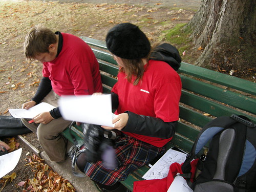
Invigilators prepare for Invigilator: Malvern

Invigilators prepare for Invigilator: Malvern

Invigilator: Malvern formed part of a programme of events taking place in and around empty shops in the centre of Malvern and a publication documenting the project is now available.

You can see a preview of the book below (Invigilator: Malvern is on pages 36-39).

The making of Location Aware

Last Friday I was in Nottingham making a new piece of work as part of the Territorial Play event organised by Trampoline.

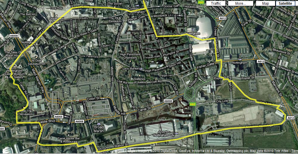
Using the same dual-GPS process as for Uncertain Eastside, I selected a route that took me through a variety of different urban environments including narrow streets, open wasteland, alongside large buildings and around the foot of the castle.

Wasteland with desire lines

Wasteland with desire lines

Each circuit of the route (2.2 miles) took approximately 45 minutes to complete and started and finished at the Broadway Media Centre where the event was hosted.

We had a ‘project room’ that we were using as a base for various tech + mapping activities. After each circuit I returned here, processed the data and turned it into a .pdf file that my glamorous assistant Russell would take to the printers whilst I set out walking again.

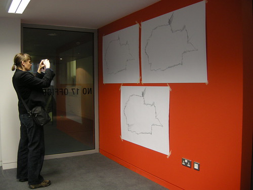
By the time I returned there would be a new print put up on the wall combining all the traces from all the previous walks.

Cumulative prints of the GPS traces

Cumulative prints of the GPS traces

I only had time for 3 circuits, but my shoes seemed to think that was plenty.

I’m really pleased with the results and had some great feedback and conversations with the other people at the event.

To share a little something of the resultant drawing – and how it relates to the landscape – I’ve added some details from the drawing to the Google Map of my route. Click on the yellow placemarkers to see the image and read the associated text.

Overview of the final route

Overview of the final route

Detail from the resultant drawing referenced to the part of the route it came from.

Detail from the resultant drawing referenced to the part of the route it came from.

So, head on over to the map: zoom in, zoom out, change views, click on things and have an explore!

Walking Route for Location Aware

I’m currently working on the route I will walk for my piece Location Aware at this Friday’s Territorial Play platform event in Nottingham.

The problem is, I don’t know Nottingham, so I’m crowd-sourcing some input on a route I’ve put together from Google Maps.

If you know Nottingham at all, then I’d be grateful for any feedback on this route (larger version here, or click though for zoom-able version on Google Maps):

My first proposed walking route - what do you think?

My first proposed walking route - what do you think?

I’m looking for the following qualities in the final route:

  • Safe for me to walk with a PDA visible in each hand.
  • Total walking length of about 45 mins (I think the current one is about an hour).
  • Passing through a range of different built environments and open spaces.
  • Starting and finishing at the Broadway Media Centre.
  • Some interesting places to see on the way. Several times during the course of the day!

I’ll be going to Nottingham on Thursday afternoon and will hopefully get a chance to investigate the route ahead of the first scheduled walk at 11am on Friday.

Prior to that though, if you can suggest any changes to make the route safer, more interesting or maybe just different, then I’d love to hear from you!

Location Aware at Territorial Play event in Nottingham

I’ll be in Nottingham this coming Friday and Saturday for the Territorial Play platform event and symposium as part of Tracing Mobility.

Detail from Uncertain Eastside - I will be using the same technique to explore Nottingham

Detail from Uncertain Eastside - I will be using the same technique to explore Nottingham

For Territorial play, Pugh will conduct a series of walks whilst carrying a satellite navigation device in each hand. Glitches in the technology and interference from the physical landscape result in anomalies in the data recorded by each device. As the journey is repeated and the resulting data overlaid, unique generative drawings are produced that reveal relationships between the fabric of the city and the behaviour of the technology.

My first walk will start at 11am and you are welcome to join me (free, there is a sign-up list at http://locationaware.eventbrite.com/), you can also join me on subsequent walks, through until the early evening, however these will be unscheduled.

The generated drawings will be on display at the Broadway Media Centre [Google map] and added to throughout the day as new layers of data are collected.


Copyright and permissions:

General blog contents released under a Creative Commons by-nc-sa license. Artworks and other projects copyright Nicola Pugh 2003-2026, all rights reserved.
If in doubt, ask.
The theme used on this WordPress-powered site started off life as Modern Clix, by Rodrigo Galindez.

RSS Feed.