Birmingham – York: the ride

I did it!

240 miles on a bike and 6 days’ worth of data beamed in near-real time to a reactive sculpture back in Birmingham.

The route I took between Birmingham and York

Kim Wall joined me for the second half of the journey, but for the first 2 and a half days it was just me, my bike and some camping gear, slowly making my way northwards and up and over the Peak District.

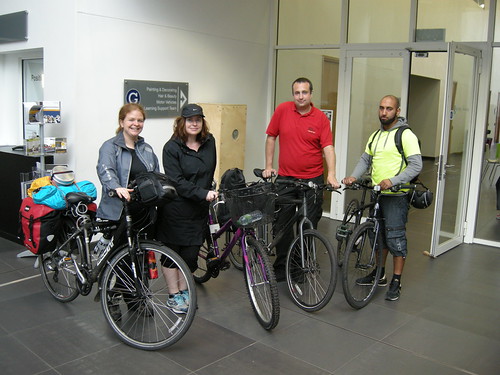
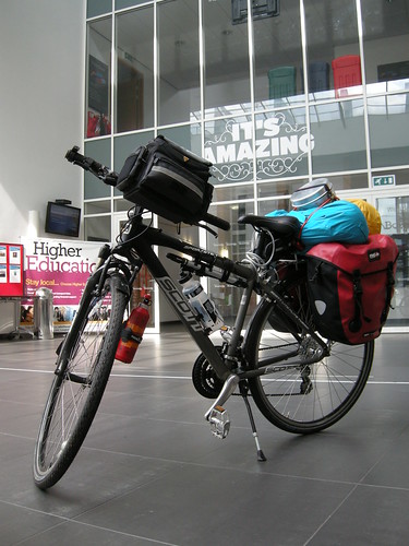
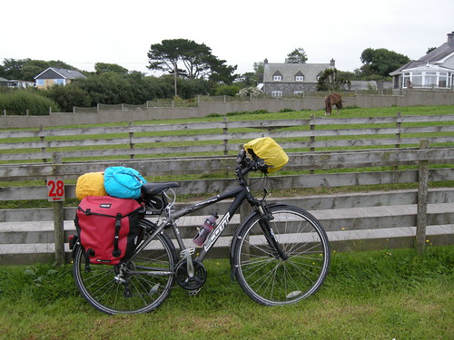
My bike as I left South West Birmingham

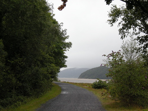
On my first night I was to be camping at Marchington Cliff near Uttoxeter. A not-too-shabby ride of about 55km if I had taken a direct route, however I wanted to ride along as many disused railway lines as possible as a nod to the project’s origins in response to the Duddeston Viaduct.

A detour to take in the Harborne Walkway added a bit more to the journey, mostly because I then also had to loop back down and around the city centre in order to avoid some canal towpath that would have been a bit of a ‘mare to try and ride along on a loaded bike.

Worth it though – I love how the Harborne Walkway is a hidden gem of a path, rising up above the houses in its own leafy world.

The Harborne Walkway

After negotiating the canal towpath under Spaghetti Junction and out of Birmingham, I was on to unfamiliar territories. I very much liked sweeping across Pipe Hayes Park and riding along the New Hall Valley Cycle Route.

After lunch at Sutton Park, I was soon out into the countryside proper and enjoying cycling along the lanes.

I’m not sure where this was, but it wasn’t in Birmingham

Lovely though it all was, 75 kilometres into the adventure I was very, very ready for the campsite and a chance to stop and rest. I just about got my tent pitched as the rain arrived.

Waking early the following morning, but expecting rain again by 9am, I made the most of some sunshine and got packed up as soon as I could.

Early morning sunshine in Staffordshire (click for full size version)

Tuesday was going to be the toughest day on the ride – climbing through the Peak District to get to Buxton. Here’s the elevation profile of the ride to put it into context: Monday had been a bit up and down, but Tuesday was up. A lot of up.

Elevation profile, with red vertical markers showing the split for each day

The Met Office’s radar map for rainfall showed a great big patch of intense yellow unleashing itself on the Peak District in the afternoon, so all the way to Ashbourne I was wondering if perhaps I should re-think and find an alternative means of transport rather than cycling an exposed off-road trail.

The rain was just starting as I got to Ashbourne and I thought I’d better check in with the tourist office to check on the sanity of what I was about to do, however a chat with a local outside Sainsbury’s put my mind at rest and I decided to get on with it.

The Tissington Trail was a gentle but constant pull uphill over its 13 miles. Similarly for the drizzle. I passed a few walkers and a handful of other cyclists, but for the most part I had it all to myself.

Panorama from the Tissington Trail (click for a full-sized version)

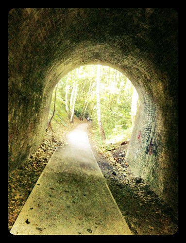
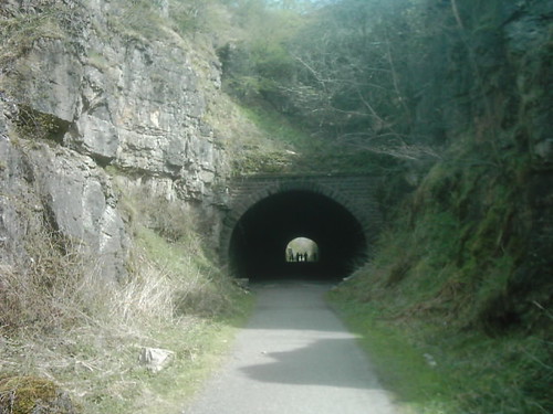
Lunch and a few fettling stops were taken whilst sheltering under bridges.

The photo doesn’t really do the view justice, but it was a great feeling when the trail emerged from under the tree cover and I found myself up on top of the hills

That night I stayed at the house of a friend’s parents, making full use of the drying facilities, curry supper and maps. Lots of maps.

Applying local knowledge, A-Z, road atlas, Ordnance Survey and various online tools to re-think the route

After the Tissington Trail I’d joined the High Peak Trail before then having to use main roads coming into Buxton. Unhappy about using these roads again (too many large, fast quarry lorries), and with much help from my hosts, I changed my plans for the following day and, instead of exiting Buxton via the High Peak Trail, on Wednesday I took the Monsal Trail instead.

The Monsal Trail alongside the River Wye near Blackwell Mill

The River Wye was looking gorgeous with the sun nice and warm. Not that that helped much a bit further on once the trail started carving its way through the rock…

Sunny + shady

The trail goes along the Wye valley, except for when it goes in the Wye valley

I stopped and started a bit to take photos and peer over the edge every so often, although I have to say that being on foot would probably have given me a greater appreciation of the viaducts which I didn’t really get to see properly.

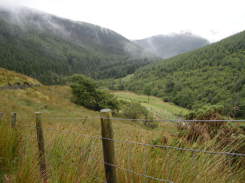
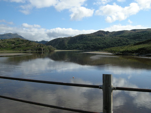
After leaving the Monsal Trail at Great Longstone I was back onto lanes and gradually working my way out of the valley. Hard work, but a mere warm-up for the hill up out of Baslow. That was 20 minutes of hard grind! Once at the top though, it felt like I was on top of the world! As noted; this is the sort of place where rivers are born.

Looking back, up on Ramsley Moor

I had a reminder of this in the form of a rainbow that appeared to my left, but fortunately I stayed on the sunny side and had a speedy freewheeling descent into Chesterfield with my speed rarely dipping below 30 kph.

(click for larger version)

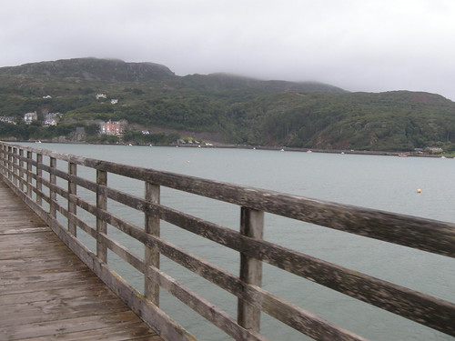
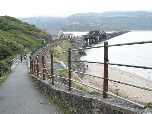
Once in Chesterfield I met up with Kim and we set off along the canal and various other incarnations of the Trans Pennine Trail. I was very impressed with the TPT and indeed we were enjoying blatting along it so much that we over-shot where we were supposed to leave it to head out towards Worksop and that night’s campsite.

Thursday’s ride was a shortish one of about 56km, a bit of a slog along rainy, busy roads into Doncaster and then a brighter final leg with a tail wind into the flatlands of the Vale of York.

Friday was my first experience of the Vale proper. Mostly this seems to consist of viewing power stations from a variety of angles without them getting noticeably closer at any point…

Lots of open space and Drax, or Eggbororough, or…

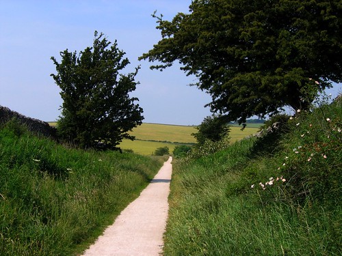
Conveniently, the Trans Pennine Trail ran from right near our campsite all the way into York, so this was a very pleasant day’s riding along quiet lanes and other interesting bits and pieces.

Breighton Airfield. (Click for a larger version …and a better view of the distant power station…)

And the power stations; always the power stations.

When we got to Pluto, I knew we weren’t too far from York.

This grey and gold field was the point where I felt I had finally made it to York:

But we officially marked our arrival with a photo on the Millennium Bridge before making our way to our host’s house and a well-earned bath. Oh, and a gig. *zonk*

#YorkRode

That then just left Saturday morning to provide the pedalling to wrap up the sculpture’s official run. With a local guide and no camping gear whatsoever, we headed out into the lanes South West of York and had a very pleasant few hours that, by chance and careful planning, ended up at The Blacksmiths Arms in Naburn.

It’s been one of those epic efforts and journeys into the unknown that’s needed looking at the lines on the map and all the photos to really begin to take in how much ground was covered and how many new things encountered. There were a few times when I was considering bailing, but on the whole there was some very nice riding and I’m very, very chuffed at what I managed to achieve.

Thanks to everyone who helped me on my way!

Birmingham – York : the route

So, in an hour or two’s time I’ll set off on a 200+ mile journey to cycle from Birmingham to York.

Birmingham to York, via a slightly lumpy bit

This project has its roots in the Duddeston Viaduct stretch of railway-line-that-never-quite-was, and so my route to York has been designed to incorporate several disused railway lines…

(click through to go to the images’ sources on Flickr)

Day 0

Ride (Birmingham - York)

As part of the launch event, I invited people to accompany my on a ride to Longbridge.

Bournville College’s new campus is on the site of the old Rover car factory. I’ll possibly be part of a programme of artist residencies taking place in the area later in the year, and as part of our initial discussions I heard about the railway line that used to service the plant.

Day 1

260/i365 Tunnel

On my first day I’ll be cycling up the Harborne Walkway, the remnants of the Harborne Railway.

Day 2

The Tissington Trail in Derbyshire

On Tuesday I’ll be joined by Kim Wall and we’ll cycle up the Tissington Trail to Buxton in the Peak District.

Day 3

High Peak Trail, Derbyshire

Wednesday: The High Peak Trail. Fortunately in the downward direction!

Later in the day we’ll also ride along the Silverhill Trail. [some images here]

Days 4 & 5

The Fisher of Dreams Sculpture on TPT Naburn Marina on River Ouse - Cropped

Here our route goes along the Trans Pennine Trail in places, including the rather marvellous sounding scale model of the solar system.

Effort

We’ll mostly be camping en route, so this is the sort of load I’ll be carrying:

Ride (Birmingham - York)

I’m not sure how much it weighs, but suffice to say I can’t lift the back wheel when my bike’s loaded up like this! I’m hoping I don’t encounter too many awkward gates along the trails…

Connection:

Ride (Birmingham - York)

Ride (Birmingham - York)

As I cycle, I’ll be transmitting data connected to the effort I’m making to the sculpture that’s currently on display at Bournville College. 30 minutes behind me, the sculpture will react to my speed, bearing, altitude, time spent journeying and total distance travelled. There’s also an indicator for the accuracy of the GPS signal the data is derived from. Spend some time with the sculpture and see what connections you make…

Ride (Birmingham - York)

Launch event ride to Longbridge

As part of the launch event for Ride (Birmingham – York) on Saturday the 14th of September, I will be cycling between Cannon Hill Park and the Bournville College campus at Longbridge.

As I cycle I will be collecting data and sending it to a sculpture in Bournville College. This data will then be ‘played back’ by the sculpture during the main launch event.

If you would like to join me on this leisurely 7 mile ride, read on…

The Logistics

The ride will be led by BikeRight! West Midlands who are very kindly supporting the event as part of the Smart Network, Smarter Choices project

All are welcome – we’ll go at the pace of the slowest rider and there will be people making sure no-one gets left behind.

Meet near the bandstand in Cannon Hill Park for 9:30am. Click on the image above to view on Open Street Map. There will be Park Run happening at the same time, so please ensure you give yourself plenty of time and please be mindful of the other people using the park.

You must be riding a road-worthy cycle in order to join the ride, as well as taking responsibility for the safety of yourself and others around you (through considerate behaviour and following the rules of the road).

BikeRight! staff will be near the bandstand from 9am in order to give your bike a quick safety check in case there is anything you are unsure about. If you do not have access to a roadworthy machine, BikeRight! have a limited number of bikes they can lend people for the ride. If you would like to borrow one of these, it must be agreed in advance – send an email to info2@bikeright.co.uk with ‘Nikki Pugh Led Ride’ in the subject.

Please make sure you have a lock to secure your cycle whilst you are inside the college.

There will not be an organised ride back from the event at Longbridge, so please make your own plans for returning home (especially important if you have borrowed a bike to get there!). There is a train station very close to the college or you can re-trace the route back to Cannon Hill Park.

There is free car-parking at Cannon Hill Park, or it is on National Cycle Route number 5 if you are cycling over from the city centre.

The Route

We will follow National Cycle Route 5 along the River Rea to Stirchley and then through Kings Norton and Northfield.

The route is about 7 miles long and mostly off-road on shared paths.
There is also a short section along a canal towpath.

The surface is not always great, and may not be suitable for road bikes with skinny tyres.

A gpx file of the route is available for download here, or you can view it on BikeHike here.

That’s it!

Let me know if you have any queries and I’ll do my best to answer them.

In short though, it’ll be a relaxed ride along a quiet route that all are welcome to take part in. If you’d rather not take part in the ride that’s fine – we’ll see you at Bournville College and you’ll still be allowed some cake!

Ride (Birmingham – York)

During the week beginning the 16th of September I will be cycling over 200 miles to York as part of my new project Ride (Birmingham – York), a commission by VINYL. (Related blog posts.)

As I cycle, I will transmit data back to a sculpture being exhibited in the foyer of Bournville College. In turn, this sculpture will change shape, colour and movement in response to the data in order to convey something of the effort being exerted on the other end.

The sculpture will be on show at the Bournville College campus in Longbridge [B31 2AJ] between the 16th and 21st of September.
Entrance is free, just introduce yourself at the front desk for a visitor’s pass.

Monday – Thursday 10:30am – 9:30pm
Friday 10:30am – 4:30pm
Saturday 10:30am – 12:30pm

Launch event:

To mark the beginning of the exhibition, there will be a launch event 10:30am-12:30pm at Bournville College on Saturday the 14th of September. Do join us for cake and a special preview of the the automaton that will be echoing Nikki’s journey to York.

On the morning of the launch event, Nikki will be cycling from Cannon Hill Park to the college campus at Longbridge. Data from this ride will be ‘played back’ via the sculpture during the launch event.

If you would like to accompany me for the leisurely 7 mile bike ride between Cannon Hill Park and the College’s campus in Longbridge, please see this page for more details.

Support:

Ride (Birmingham – York) has been commissioned by VINYL and supported using public funding by Arts Council England.

In addition to this, the project would not have been possible without the generosity and support of many different people. In particular, I would like to thank:

  • Jez Higgins and Mike Cummins for building the mobile app and database system that power the sculpture.
  • Garmin Europe Ltd for the donation of a GPS device and mapping to use for navigation whilst on the ride.
  • BikeRight! West Midlands for supporting the ride for the launch event.
  • Bournville College for hosting the sculpture.
  • Kim Wall for accompanying me on the ride to York, and all the many people in various cycling groups and fora who have one way or another helped me to do this.

Ride: Hardware, Software and Wetware testing

Last week I had the opportunity to join some friends on part of a cycling tour in Wales.

The tracks from the cycling I did. (Click through for a larger version.)

I wasn’t able to make all of it, but I thought the bit I could do would be a very good opportunity to test out a few things for my upcoming project Ride (Birmingham – York), in which I will be cycling and camping my way via a 200-or-so-mile route to York whilst live-streaming data back to a reactive sculpture here in Birmingham.

Fully Loaded (and mostly waterproofed)

The Welsh trip was my first proper experience of bikepacking. I’m please to report that, bar a few broken spokes and a comedy last-minute puncture, my bike and camping kit held up to the weather and geography. There was plenty of both!

My first day took us over the mountains above Corris. It was cloudy and very steep…

Above Corris

Above Corris

Above Corris

Linking back to the Ride project, I also got to sample some more cycle paths along former railway lines (also alongside current ones).

These were altogether more civilised gradients!

Old railway line to Barmouth

Bridge at Barmouth

Bridge at Barmouth

Pont Briwet

Porthmadog Cob

Railway path

So, I now know I mostly have knees, cycling kit and camping kit up to the task.

Next time however, I might forgo the toad in my tent…

Tent toad

More of my photos from the trip are in this Flickr set.

Many thanks to Peter, Kim, Megan and Wendy for an excellent few days, good cycling and plenty of cake.
~~~~~

Back in Birmingham I’ve been working with programmers Jez Higgins and Mike Cummins to put together an Android app and a database system to power the reactive sculpture. The idea is that the sculpture will change colour/shape/speed in response to the amount of effort going on at the other end with me journeying on my bike.

The Welsh tour was also a chance to test the app software under serious conditions similar to what it will have to perform under next month. I’m a big fan of testing, and this was a brilliant way of highlighting further improvements and modifications that needed to be made.

We’ve since tackled a bunch of those and, along with a databasing session with Mike yesterday, I’m happy to be able to report that we now have the following chain all working together:

Me on my bike -> app on my phone on my bike -> online database -> Arduino -> blinkenlights and other physical outputs.

My next task is to develop the physical outputs and construct the sculpture.

~~~~~

The ride to York, and therefore the time during which the sculpture will be active, will probably start on the 16th of September and continue until the 22nd.

The sculpture will, all being well, be housed at the new Longbridge campus of Bournville College and I’m toying with a gentle bike ride down the off-road cycle path from Cannon Hill Park to Longbridge as part of a launch event on Saturday the 14th.

Watch this space for more information as it gets confirmed…

Garmin support my upcoming project ‘Ride’

Following on from the recent conversation I had with Garmin‘s Laura Tomei at the Fermynwoods event Art + Satellites, I’m very pleased to be able to announce that they’re supporting my upcoming project Ride (Birmingham – York) through the donation of a Dakota 20 navigation device. This should mean I can actually find my way to York!

Ride has come about from a commission from VINYL: you can read some of my early thoughts here and hear me talk about it in this talk I did for Pecha Kucha Night Afternoon Coventry:

PKN Cov Lunch Nikki Pugh HD from MINDRIOT PRODUCTIONS on Vimeo.

Short version: in September I’ll be cycling from Birmingham to York whilst streaming data back to a reactive sculpture somewhere in Brum.

Meanwhile, the Dakota arrived the day before yesterday and I had to set about learning the language of Garmin devices. It’s a bit of a learning curve, but I’m starting to get the hang of it now!

After a quick play and familiarising myself with the menus and settings, I naturally wanted to take it out on the bike to see how it behaves in use.

This required molishing a quick bike mount. Here’s what I came up with:

PCV foam board with cable-tie holes and velcro slots

And here it is on the bike and out and about

It worked really well – only coming off when I hit a pothole at 26 miles per hour!

Even surviving canal towpaths!

Anyway, a brief moment of DIY bodge glory, as yesterday a RAM mount arrived in the post.

I didn’t buy any of the mounting component stuff, just the bit that clips directly around the Garmin. Yesterday I made do with simply cable-tying this to my handlebars, but this morning I’ve attached it onto a spare light mount to produce this:

So, off we go into the wide yonder to find out what this thing can do and what I can do with it!

Cause and effect

I’ve been commissioned by Andre de Jong at the artist-led space VINYL to produce a piece of work for this Autumn, the set-up being that I’ve been paired with artist Nita Newman and Andre’s leaving us to riff off each other and see what happens.

A while ago Nita and I went for a stroll around Digbeth looking for inspiration. We explored a few different spaces and ideas, but we kept coming back to the Duddeston viaduct: 355 yards of futile endeavour.

Duddeston viaduct

… originally built to connect the GWR‘s B&OJR line to the LNWR‘s Curzon Street station. As stated elsewhere, the GWR fell victim to the LNWR’s politicking which meant that whilst the LNWR stopped the GWR gaining access to their station, the LNWR still demanded the viaduct be built even though they knew it would never be used.warwickshirerailways.com

Nita’s developing a site specific audio composition (call for participants currently on her website at http://nitanewman.wordpress.com/news/), so I’m taking my cues as being the following:

  • effort
  • journeying
  • separation
  • railways and engineering

I have some proto ideas that I’m investigating for feasibility since they’ll involve some data-streaming from a moving bicycle.

In the meantime I’ve also been doing some exploring of old railway lines and cunning mechanisms.

Stop. Look. Listen.

Machinery!

Machinery!

mill pr0n

mill pr0n

mill pr0n

mill pr0n


Copyright and permissions:

General blog contents released under a Creative Commons by-nc-sa license. Artworks and other projects copyright Nicola Pugh 2003-2024, all rights reserved.
If in doubt, ask.
The theme used on this WordPress-powered site started off life as Modern Clix, by Rodrigo Galindez.

RSS Feed.